Hurricane Babe
Later that day, Babe intensified into a hurricane and attained its peak strength with winds of 75 mph (120 km/h) and a barometric pressure of 995 mbar (hPa; 29.38 inHg).
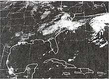
The newly formed system then interacted with an upper tropospheric cyclonic vortex situated near the Florida coastline.
The following day, Convective banding features around the cyclone led to the National Hurricane Center (NHC) upgrading the system to Tropical Storm Babe.
[3] Around this time, reconnaissance missions into the storm found a closed eyewall with an eye measuring roughly 23 mi (37 km) in diameter.
[2] Early on September 5, reconnaissance found a central barometric pressure of 995 mbar (hPa; 29.38 inHg), the lowest recorded in relation to the storm.
[2] Later that day, Hurricane Babe made landfall near Cocodrie, Louisiana and quickly weakened to a tropical storm.
[2][3] While crossing South Carolina, forecasters thought that the system would emerge into the Atlantic Ocean and regenerate into a tropical depression.
[3] Upon the storm's formation on September 3, gale warnings were issued for areas along the north-central coast of the Gulf of Mexico.
By September 5, hurricane warnings were posted for areas between Vermilion Bay to the mouth of the Mississippi River in Louisiana.
In Grand Isle, roughly 200 civil defense workers stayed behind in the town hall after the cities 2,300 residents evacuated.
[9] Prior to becoming a subtropical depression, Babe produced scattered rainfall in Florida, with peak amounts near 3 in (76 mm) falling around Lake Okeechobee.
[11] Upon making landfall, Babe produced a storm surge of 5 ft (1.5 m), leading to minor coastal flooding.
[2] Due to the storm's quick deterioration after moving inland, the NHC presumed that hurricane-force winds did not impact land.

Tropical storm (39–73 mph, 63–118 km/h)
Category 1 (74–95 mph, 119–153 km/h)
Category 2 (96–110 mph, 154–177 km/h)
Category 3 (111–129 mph, 178–208 km/h)
Category 4 (130–156 mph, 209–251 km/h)
Category 5 (≥157 mph, ≥252 km/h)
Unknown