Caesars Head, South Carolina
Caesars Head is an unincorporated community and census-designated place (CDP) on top of Caesars Head, a mountain in Greenville County, South Carolina, United States.
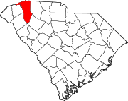
[4] The CDP is in northwestern Greenville County along U.S. Route 276, 2 miles (3 km) south of the North Carolina border.
The 3,208-foot (978 m) summit of Caesars Head is in the western part of the CDP, and most of the residential development is in the northeastern part, at elevations ranging from 2,800 to 3,200 feet (850 to 980 m) above sea level.
The remainder of the CDP is within Caesars Head State Park.
This South Carolina state location article is a stub.