Interstate 680 (Nebraska–Iowa)
The freeway passes through a diverse range of scenes and terrains—the urban setting of Omaha, the Missouri River and its valley, the rugged Loess Hills, and the farmland of Pottawattamie County, Iowa.
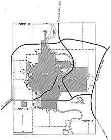
The freeway heads north through the heart of West Omaha; it serves as a dividing line of several residential neighborhoods.
[5][6] Two miles (3.2 km) north of West Center Road, which, prior to 2003, was Nebraska Highway 38 (N-38),[7] is a new interchange with US Route 6 (US 6), known as Dodge Street in Omaha.
South of this interchange, I-680 travels through residential neighborhoods, but, to the east, the population thins and the Interstate passes through farmland for 4.5 miles (7.2 km).
In the early 1970s, the American Association of State Highway and Transportation Officials (AASHTO) decided that Interstates with a directional suffix, such as I-80N, would have to be renumbered.
[15] A week later, water was diverted and drained from the area around the northern I-29 interchange to allow traffic to use the roads.
[18] The road was officially reopened on November 2 during a ceremony in Crescent hosted by Governor Terry Branstad.
[19] Iowa DOT closed I-680 for three separate periods during the 2019 floods: Due to I-29 and I-680 being subjected to flooding from the adjacent Missouri River, Iowa DOT officials sought to reduce confusion among drivers who were forced to use I-680 and I-80 as a detour around floodwaters.
Iowa DOT updated its online maps and announced that the signage would be changed just weeks after the official approval by AASHTO.
[26] Due to excessive rainfall in the Siouxland area upstream of Omaha/Council Bluffs, flooding of the Missouri River caused Iowa DOT to close I-29 and I-680, starting at 1am on Wednesday, June 26, 2024.