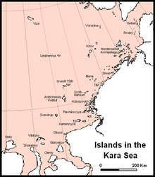
Kara Sea
[2] It is named after the Kara river (flowing into Baydaratskaya Bay), which is now relatively insignificant but which played an important role in the Russian conquest of northern Siberia.
[7] Simulations with the Hamburg shelf ocean model (HAMSOM) suggest that no typical water current pattern consists in the Kara Sea throughout the year.
[10] This rapid warming also makes it easier to detect any potential connections between the state of sea ice and weather conditions elsewhere than in any other area.
[13] There are also potential links to summer precipitation:[14] a connection has been proposed between the reduced BKS ice extent in November–December and greater June rainfall over South China.
In 1556 Stephen Borough sailed in the Searchthrift to try to reach the Ob River, but he was stopped by ice and fog at the entrance to the Kara Sea.
In 1878, Finnish explorer Adolf Erik Nordenskiöld on ship Vega sailed across the Kara Sea from Gothenburg, along the coast of Siberia, and despite the ice packs, got to 180° longitude by early September.
In February 1914 Sedov headed to the North Pole with two sailors and three sledges, but he fell ill and died on Rudolf Island.
Georgy Brusilov attempted to navigate the Northeast Passage, was trapped in the Kara Sea, and drifted northward for more than two years reaching latitude 83° 17' N. Thirteen men, headed by Valerian Albanov, left the vessel and started across the ice to Franz Josef Land, but only Albanov and one sailor (Alexander Konrad) survived after a gruesome three-month ordeal.
The survivors brought the ship log of St. Anna, the map of her drift, and daily meteorological records, but the destiny of those who stayed on board remains unknown.
In 1929 and 1930 the Icebreaker Sedov carried groups of scientists to Severnaya Zemlya, the last major piece of unsurveyed territory in the Soviet Arctic; the archipelago was completely mapped under Georgy Ushakov between 1930 and 1932.
Particularly worth noting are three cruises of the Icebreaker Sadko, which went farther north than most; in 1935 and 1936 the last unexplored areas in the northern Kara Sea were examined and the small and elusive Ushakov Island was discovered.
[23] Solid high- and low-level wastes unloaded from Northern Fleet nuclear submarines during reactor refuelings were dumped in the Kara Sea, mainly in the shallow fjords of Novaya Zemlya, where the depths of the dumping sites range from 12 to 135 meters, and in the Novaya Zemlya Trough at depths of up to 380 meters.
A subsequent appraisal by the International Atomic Energy Agency showed that releases are low and localized from the 16 naval reactors (reported by the IAEA as having come from seven submarines and the icebreaker Lenin) which were dumped at five sites in the Kara Sea.
[25] At a seminar in February 2012 it was revealed that the reactors on board the submarine could re-achieve criticality and explode (a buildup of heat leading to a steam explosion vs. nuclear).
Nearby, the Franz Josef Land and Severny Island in northern Novaya Zemlya are also registered as a sanctuary, the Russian Arctic National Park.