Laurel Highlands Hiking Trail
It begins at Ohiopyle State Park and travels generally to the northeast, and ends at Conemaugh Gorge near Johnstown.
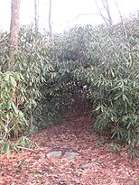
[1] Except for climbs out of river valleys at its southwestern and northeastern ends, the trail is relatively level and appropriate for winter uses such as cross-country skiing and snowshoeing.
Parking lots at highway crossings serve as intermediate trailheads and some have drinking water.
The trail runs east through the park and parallel to the Youghiogheny River for the first 6 miles (9.7 km).
[6] After departing from the river valley, the trail embarks on its only significant climb (when hiked in this direction) as it ascends to the top of Laurel Hill.
[8] Just before 15 miles the trail enters Laurel Ridge State Park for the first time, where it continues northeast.
[13][14] The access trail to the eighth and final overnight shelter is reached at about 64 miles; unlike the others, this one is not near a major road crossing.
The Laurel Highlands Hiking Trail ends after 70.1 miles at a parking lot that is reached via a side road a short distance from PA Route 56.
Hikers using the shelters are required to make reservations and pay a fee with staff at Laurel Ridge State Park before setting out on their hikes.