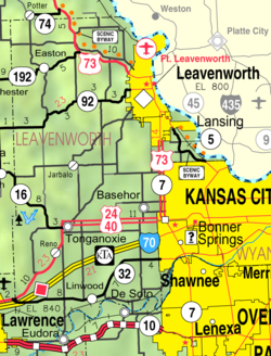
Leavenworth County, Kansas
For many millennia, the Great Plains of North America was inhabited by nomadic Native Americans.
In 1802, Spain returned most of the land to France, but keeping title to about 7,500 square miles.
In 1803, most of the land for modern day Kansas was acquired by the United States from France as part of the 828,000 square mile Louisiana Purchase for 2.83 cents per acre.
It was named, as was its county seat, after Henry Leavenworth, an officer in the War of 1812.
[7][8] The county is a part of the Kansas City, MO-KS Metropolitan Statistical Area.
21.7% of all households were made up of individuals, and 8.1% had someone living alone who was 65 years of age or older.
Leavenworth County was a prohibition, or "dry", county until the Kansas Constitution was amended in 1986 and voters approved the sale of alcoholic liquor by the individual drink with a 30 percent food sales requirement.
The cities of Lansing and Leavenworth are considered governmentally independent and are excluded from the census figures for the townships.

