List of Northern Cordilleran volcanoes
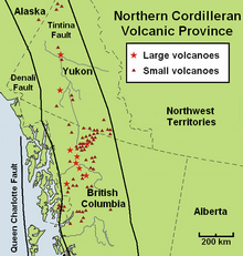
The geography of northwestern British Columbia and Yukon, Canada is dominated by volcanoes of the Northern Cordilleran Volcanic Province formed due to continental rifting of the North American Plate.
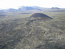
Many contemporary volcanoes rise as young parasitic cones from flank vents or at a central crater.
[12] The northernmost portion of the Northern Cordilleran Volcanic Province extends just across the Alaska-Yukon border into the Southeast Fairbanks Census Area of eastcentral Alaska.
Here, a single cinder cone, dated at 177,000 years old occurs within the metamorphic and granitic composed upland of the Yukon–Tanana terrane.
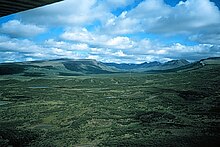
[14] It is the northernmost Holocene age volcanic field in Canada, consisting of a sequence of valley-filling basalt and basanite lava flows.
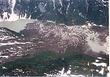
[14] Further south near the capital city of Whitehorse, a group of volcanoes and lava flows were constructed near Alligator Lake possibly in the past 10,000 years.
[4] The Northern Cordilleran volcanoes of northwestern British Columbia are disposed along short, northerly trending segments which are unmistakably involved with north-trending rift structures including synvolcanic grabens and grabens with one major fault line along only one of the boundaries (half-grabens) similar to those associated with the East African Rift, which extends from the Afar triple junction southward across eastern Africa.