List of longest streams of Idaho
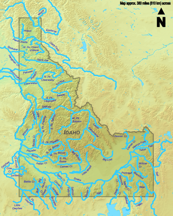
A total of seventy streams that are at least 50 miles (80 km) long flow through the U.S. state of Idaho.
It begins in Wyoming and flows through Idaho for 769 miles (1,238 km), and then through Oregon and Washington.
Some of the other streams also cross borders between Idaho and Montana, Nevada, Oregon, Utah, Washington, or Wyoming, but the majority flow entirely within Idaho, the longest of which is the Salmon River at 425 miles (684 km).
Consequently, the predominant direction of the state's streamflow is northwest towards the Columbia River and its mouth at the Pacific Ocean.
Source data for the table below comes from topographic maps created by the United States Geological Survey and published online by TopoQuest, and on the Idaho Road and Recreation Atlas, the National Hydrography Dataset, the Geographic Names Information System, and other sources as noted.