Map series
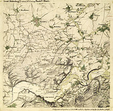
An example of such a map series is the Topographic Atlas of the Kingdom of Hanover and the Duchy of Brunswick.
It is technically very difficult, and it would be highly impractical, to print, e.g., the National Map of Switzerland on a single sheet at a scale of 1:25,000 (that particular map would be about 9 metres (30 ft) high and 14 metres (46 ft) wide).
For that reason, map series are issued and preserved in loose-leaf form.
In extreme cases, a map series can include thousands of sheets.
Map series are divided into particular systems of single sheets named and numbered according to common principles.
In practice, variants of the mercator projection are the most widely used today, frequently in conjunction with the UTM coordinate system.
The sheets are divided from each other either square to the map grid, or along the meridians and parallels.
Sheet numbers of each further smaller scale will bear a different system of suffixes (e.g., Roman numerals, small letters, etc.).
These numbers can become very complex, but at the same time allow "the experts" to gain at least a rough location of the map sheet on the globe.
In Germany, the federal States have responsibility for the production and updating of the map series up to and including 1:100,000 scale, and for larger scales the responsibility rests with the Federal Office of Land Surveying.
The small scale map series are edited by the Federal Agency for Cartography and Geodesy.
A noted exception is the quadrangle series of the United States in 1:24,000 scale.
Especially in the German-speaking countries, the 19th century was the golden era of the map series then described as Topographic Atlases.
Most of the German states of the 19th century introduced their own map series, which were only later adapted, under Prussian guidance, to coordinate with each other.
Historical map series can still be used by historians, landscape architects, etc., for comparative studies.
In contrast with single sheet maps, map series have the advantage of representing a larger area in a uniform manner and have documented card network designs and recording methods.