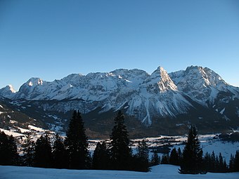
Mieming Range
Whilst the region around the Coburger Hut and the lakes of Seebensee and Drachensee in the west (Ehrwalder Sonnenspitze and Vorderer Tajakopf with its new klettersteig over the Tajakante) and the Hohe Munde in the extreme east receive large numbers of visitors, the less developed central area remains very quiet.
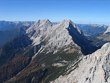
Between the peaks of the Sonnenspitze, Wetterstein and Daniel, three geological units meet that, during the course of mountain building, were piled on top of one another as nappes and today are adjacent to one together.
There are no older rocks that predate those from in the first window, and the more recent ones have been eroded by wind, weather and water since the Alpine orogeny about 35 million years ago.
Marine deposits that were near the shore, made of limestones, dolomitic rocks and breccias, are still layered in places in a narrow strip of land between Langlehn and Igelskar (Reichenhall Strata).
During the next time period, a thick sequence of dark limestones was formed - the Alpine muschelkalks - which, when struck, often smell slightly of bitumen and are striking because of their uneven, irregular surface layers.
Irregularly shaped, dark brown to black hornfels nodules (Knauern) and greenish tuffs occur in these limestones that indicate the presence of nearby Stromboli-like volcanoes.
Next, reefs began to develop in the shallow waters of the sea, in which small coralline algae (haptophytes) and corals lived.
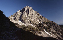
Because Wetterstein limestone contains few plant nutrients, its scree and talus slopes are largely unvegetated and this tends to characterise the scene above the tree line.
For example, the steep slopes falling away from the Mieminger Mountains into the Ehrwald Basin or the Leutasch River are the front of such a nappe, also called the Inn Valley Stack (Inntaldecke).
The relatively recent deposits in the up to 70 metre deep moors are predominantly gravels, shingles, clay, humus and peat; the latter even being used at one time near Lermoos for the lead-zinc smelter of the Silberleithen cooperative (Gewerkschaft).
The major change to the landscape since the last ice age was the Fern Pass landslide that filled the valley between Biberwier and Nassereith to a depth of 200 metres.
To the south the River Inn forms the boundary of the range from the Niederbach stream near Inzing upstream as far as its confluence with the Gurglbach near Imst.