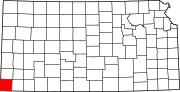
Morton County, Kansas
For many millennia, the Great Plains of North America was inhabited by nomadic Native Americans.
In 1802, Spain returned most of the land to France, but keeping title to about 7,500 square miles.
In 1803, most of the land for modern day Kansas was acquired by the United States from France as part of the 828,000 square mile Louisiana Purchase for 2.83 cents per acre.
In 1848, after the Mexican–American War, the territorial gain in the Treaty of Guadalupe Hidalgo with Mexico brought into the United States all or part of land for ten future states, including southwest Kansas.
Due to discrepancies in the number of signatures compared to eligible voters, an investigation delayed the decision until November 1886, when Richfield was officially declared the temporary county seat.
Following this, Richfield was confirmed as the permanent county seat in a February 1887 election, amidst reports of political maneuvering.
The county experienced significant fluctuations in population due to economic conditions, dropping from 2,560 in the years following its organization to as low as 304 over the next decade.
The U.S. government purchased some of the impacted and abandoned land and eventually incorporated it into the Comanche National Grassland.
[7] The county is the location of the 8 Mile Corner tripoint, where Kansas borders Colorado and Oklahoma.
Jimmy Carter almost carried the county in 1976, but Gerald Ford eventually won by .2%.


