New York State Route 17A
Its western terminus is located in the village of Goshen at a junction with NY 17 (Future I-86), and its eastern terminus is at another intersection with NY 17 located in Southfields.
The Greenwood Lake–Goshen portion of NY 17A was originally designated as part of New York State Route 55 in the 1920s.
The route quickly climbs to some of the hillier areas south of Goshen, offering views of not only Orange County's Black Dirt Region but Pochuck Mountain and High Point to the south in New Jersey.
[3] Once out of the village, NY 17A and NY 94 begin to climb again, this time offering some panoramic views to the north, all the way to the Shawangunk Ridge and even the Catskill Mountains beyond them in clear enough weather.
The road is surprisingly little developed in this area, with only one gas station between Florida and Warwick, its next stop, which likewise presents itself after a descent.
[3] The road begins to climb again over the next few miles, passing a county park and finally the small Mount Peter ski area before crossing the Appalachian Trail along the ridgecrest of Bellvale Mountain.
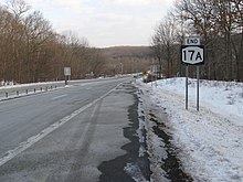
[3] Leaving Greenwood Lake, NY 17A climbs once again to cross another ridge before descending and expanding to a four-lane expressway to pass through Sterling Forest and reach its eastern terminus at NY 17 in Southfields.