New York State Route 17M
It is a busy main street in Middletown and the village of Monroe; in the former, it divides into a parkway for several blocks and forms the city's major commercial strip, located between the downtown district and an interchange with Interstate 84 (I-84).
The portions of NY 17M that lie north and east of the city of Middletown are maintained by the New York State Department of Transportation (NYSDOT).
[4][5] The junction was just north of the former right-of-way of the New York, Ontario and Western Railway,[6] which NY 17M crosses as it makes its way southward over some gentle, lightly developed hills.
[7] Continuing on, NY 17M traverses increasingly developed areas, passing through the hamlet of Rockville on its way to the densely populated neighborhood of Washington Heights, situated just outside Middletown.
This stretch continues for five blocks along the southern edge of downtown Middletown to Academy Avenue, where NY 17M turns right and heads southward.
[4] As Dolson Avenue, NY 17M passes by a single residential block before entering a linear commercial district that follows the highway to an interchange with I-84 roughly 1.5 miles (2.4 km) to the south.
Together, they cross over I-84 at exit 3, providing access to the cities of Port Jervis and Newburgh in the western and eastern parts of the county, respectively.
The road narrows to two lanes as the combined highways begin a slow, gentle descent through less developed areas to the bridge over the Wallkill River, situated at the northern tip of the county's Black Dirt Region.
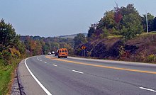
Past the climb, development aside the road picks up slightly, although most of the land around the highway remains undeveloped as open fields or forests.
[4] Just inside the town line, NY 17M turns southward, leaving the vicinity of the Quickway and entering the village of Monroe.
Despite this fact, it still serves as one of the community's major commercial strips, intersecting NY 208 in a built-up area due west of downtown.
The unsigned legislative route extended across the Southern Tier of New York, beginning near the shores of Lake Erie in Westfield and ending at the Hudson River in Highland Falls.
[16] The Goshen–Chester and Chester–Harriman segments of the Quickway were completed in October 1954 and August 1955, respectively, creating a continuous limited-access highway between Fair Oaks and the New York State Thruway.
When the route was first assigned, it continued south from Wickham Avenue on North Street, proceeding into what was then the main commercial hub of the city.
The westbound on-ramp was converted into a residential street known as Sands Road West while the eastbound half of the exit was completely removed.