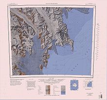
Northern Foothills
It was named by the Northern Party of the British Antarctic Expedition, 1910–13 (BrAE), because during field operations Inexpressible Island, close southward, was originally referred to as the "Southern Foothills.
The mouth of the Priestley Glacier flows past the western side of the foothills, merging into the Nansen Ice Sheet.
A mountain 1,020 metres (3,350 ft) high, which stands 3 nautical miles (5.6 km; 3.5 mi) northeast of Cape Canwe and is the highest point in the Northern Foothills.
Mapped by the Northern Party of the BrAE, 1910-13, and named for Petty Officer George P. Abbott, RN, a member of the expedition.
A high rock bluff 3 nautical miles (5.6 km; 3.5 mi) north of Vegetation Island, forming the west extremity of the Northern Foothills.
A rocky point which projects from the southwest part of the Northern Foothills, 4 nautical miles (7.4 km; 4.6 mi) northwest of Cape Russell.
A narrows located near the east edge of the Nansen Ice Sheet, lying just north of Evans Cove between Inexpressible Island and the Northern Foothills.