Ontario Highway 71
[3] The highway begins at the international bridge in Fort Frances; within the United States, the road continues south as US 53 and US 71 in Minnesota.
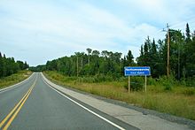
[4] North of the Manitou Rapids Reserve, Highway 71 presses through a large swath of land mostly occupied by horse and cattle ranches.
[4] The highway passes through Finland and enters the Boreal Forest, descending into the Canadian Shield over the course of a kilometre and a half (approximately one mile).
[5] From this point to its northern terminus, the highway crosses through rugged and isolated terrain, curving around lakes, rivers and mountains on its northward journey.
[4] Here the route crosses the Sioux Narrows Bridge, the last part of the highway to be constructed and a formidable engineering obstacle in the 1930s.
[8] North of Sioux Narrows, the highway meanders northward through an uninhabited region, zigzagging among the numerous lakes that dot Kenora District and crossing the Black River.
[10] In 1911, James Arthur Mathieu was elected as a Member of Provincial Parliament (MPP) in the Rainy River riding.
[14] Unlike the Cloverleaf Trail, the Fort Frances – Kenora Highway, as it was known prior to its opening, was constructed through the rugged terrain of the Canadian Shield.
Rocks, forests, lakes, muskeg, and insects served as major hindrances during construction of the 100-kilometre-long (62 mi) highway, which progressed from both ends.
Construction on this bridge was underway by March 1936; it was rapidly assembled using old-growth Douglas fir from British Columbia (BC) as the main structural members.
[8][15] On July 1, 1936, Premier Mitch Hepburn attended a ceremony in front of the Rainy Lake Hotel in Fort Frances.
[8] On a rainy afternoon, at 5:30 p.m., Peter Heenan handed Hepburn a pair of scissors with which to cut the ribbon crossing the road and declare the highway open.
[11] The Cloverleaf Trail and the Heenan Highway were assumed by the DHO shortly after its merger with the Department of Northern Development.
Following the merger, the DHO began assigning trunk roads throughout northern Ontario as part of the provincial highway network.