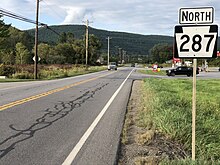
Pennsylvania Route 287
The route follows Larrys Creek through several isolated communities, including Salladasburg and English Center, before working its way towards Hoytville, where it meets PA 414.
Much of the current-day alignment for PA 287 has been constructed through many different post, plank and turnpike roads in Lycoming and Tioga counties.
This service was used and then decommissioned by 1835, when a new system, which stretched from Wellsboro and past Willardsburg to the community of Lawrenceville, was established.
[2] This route followed the alignment of PA 287, making stops in Middlebury Center, Holliday, Willardsburg and Mitchell's Creek before ending in Lawrenceville.
This mail route was truncated back to Willardsburg in 1840, when the nearby Corning and Blossburg Railroad was completed.
In 1848, the Pennsylvania State Legislature approved and chartered construction of a brand new plank road in the valley, to be called the Tioga and Elmira Plank Road, following the alignments of current-day PA 287, PA 328 and New York State Route 328 to Elmira, New York.
Construction was unable to start in 1848,[3] so a supplement to the charter was amended on April 5, 1849,[3] which extended the work period to continue until 1856.
In 1851, the plank road was complete from Wellsboro to Tioga, and the thoroughfare became highly used by people transporting lumber, agriculture and merchandise.
This helped farmers and producers in the communities of Middlebury Center, Holliday and Delmar (now the area of Wellsboro Junction).
The 17 miles (27 km) long piece of plank road, created in the original charter from Tioga to Lawrenceville, was never constructed.
Williamson himself was awarded the job as contractor, and in 1850, using full advantage of woodsmen who were unemployed, low wages, and wasted hemlock log trees, began construction.
The common transport on the road was bark and hides, along with hauling leather over to the Larrys Creek Railroad.
On June 1, 1889, a major flood hit the area around the plank road, and when things were all said and done, it had experienced extensive damage.
PA 287 intersects with Zinck Road, where the roadway becomes highly developed, following the route past residential homes and a large factory.
The highway continues northward in the fields north of Brookside until after Hughes Road, where it enters deep forests once again.
[24] PA 287 winds around curves, until the intersection with Lick Run Road, where it turns to the northwest, entering the isolated community of English Center.
In English Center, the route intersects with Little Pine Creek Road, where PA 287 turns to the north.
The forests began to clear as PA 287 enters the community of Pine Township, where the route continues northward, through fields and tree patches.
At an intersection with Mount Pleasant Road, PA 287 turns to the northeast, bending around deep forests.
A short distance later, the highways enter the highly developed area in Hoytville in Morris Township.
After Morris Township, most of the route becomes surrounded by forests, except for a distance with residential homes following the northbound lanes.
[24] PA 287 begins to parallel a waterway, entering the community of Antrim, which is surrounded mainly by forests.
After Antrim, the highway continues northward through the deep forests for several miles, until entering the community of Knapp.
In Knapp, PA 287 continues to the northeast, passing several fields and intersecting with a local road towards Broughton Hollow.
At an intersection with Dean Hill Road, the highway turns to the northeast through the fields, entering Coolidge Hollows, a small farming community.
Approaching the intersection with Shumway Hill Road, the highway makes a gradual bend to the northwest, passing a large pond to the west, where it gains the name of Central Avenue as the route enters the community of Wellsboro.
US 6 and PA 287 head to the northeast through the community center, passing to the east of Wellsboro Cemetery before the two highways turn to the northwest along Tioga Street.
The route continues to the northeast, entering the community of Middlebury Center, where it intersects with the terminus of PA 249 and Mill Plank Road.
The route crosses over a river and heads on a straight northeast alignment, passing through a residential community.
The route heads to the north, crossing the Tioga Dam along the Hammond Reservoir and entering the community of Crooked Creek.