Reno County, Kansas
[1] The county is named for Jesse Reno, a general during the American Civil War.
For many millennia, the Great Plains of North America was inhabited by nomadic Native Americans.
In 1802, Spain returned most of the land to France, but keeping title to about 7,500 square miles.
In 1803, most of the land for modern day Kansas was acquired by the United States from France as part of the 828,000 square mile Louisiana Purchase for 2.83 cents per acre.
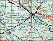
In 1887, the Chicago, Kansas and Nebraska Railway extended its main line from Herington to Pratt.
[4] This main line connected Herington, Ramona, Tampa, Durham, Waldeck, Canton, Galva, McPherson, Groveland, Inman, Medora, Hutchinson, Whiteside, Partridge, Arlington, Langdon, Turon, Preston, Natrona, Pratt.
However, 1988 was somewhat close as Michael Dukakis lost the county by only 5 percentage points due to a persistent drought and farm crisis.
[13] † means a community is designated a Census-Designated Place (CDP) by the United States Census Bureau.
The cities of Hutchinson and Nickerson are considered governmentally independent and are excluded from the census figures for the townships.


