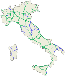
Roads in Italy
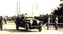
[6] Piero Puricelli, a civil engineer and entrepreneur, received the first authorization to build a public-utility fast road in 1921, and completed the construction (one lane in each direction) between 1924 and 1926.
The extension of the road network made it necessary in 1911 to update the list drawn up almost 30 years earlier, formalized with Royal Decree no.
The advent of the automobile, which required the availability of fast and well-paved roads, changed the situation, and in the immediate post-war period it was decided to revisit the issue.
The growing centralization of power of the fascist regime however led to the definitive affirmation of the centralist management model,[17] which culminated in 1928 with the foundation of the Azienda Autonoma Statale della Strada (AASS) (law 17 May 1928, n. 1094, Official Gazette n. 127 of 05/31/1928); it then became ANAS in 1946.
[6] Piero Puricelli, a civil engineer and entrepreneur, received the first authorization to build a public-utility fast road in 1921, and completed the construction (one lane in each direction) between 1924 and 1926.
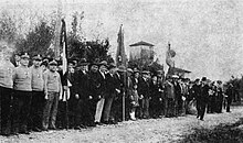
[18] In 1927 the Milan-Bergamo motorway was opened (part of the current Autostrada A4) whose concessionary company was owned by Piero Puricelli.
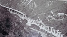
[20] In 1939, a year before Italy entered into the World War II, the construction of the Genoa-Savona motorway (the current Autostrada A10) was approved.
Legislative decree 17 April 1948, n. 547 defines motorways "as those communication routes reserved for paid transit of motor vehicles, built and operated by the A.N.A.S.
The law of 7 February 1961, n. 59 defines motorways "as those communication routes exclusively reserved for the selected transit, usually for a fee, of motor vehicles and motorbikes, without level crossings or in any case unattended, which are recognized as such by decree of the Minister for Public Works".
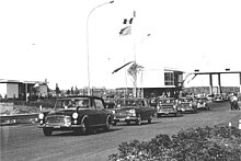
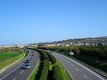
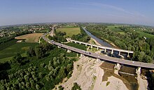
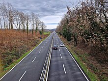
[22] Starting from the mid-1960s, ANAS also began to build a network of dual carriageways which often flanked or completed the routes of the state highways, but did not formally replace them.
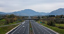
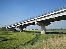
Italy was the first country in the world to build motorways, the so-called autostrade, reserved for fast traffic and for motor vehicles only.
[6] Other motorways (or autostrade) built before World War II in Italy were Naples-Pompeii, Florence-Pisa, Padua-Venice, Milan-Turin, Milan-Bergamo-Brescia and Rome-Ostia.
From 1 October 2012 the granting body is the Ministry of Infrastructure and Transport and no longer Anas[34] and the majority (5,773.4 km (3,587.4 mi) in 2009[35]) are subject to toll payments.
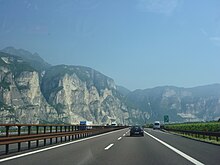
Legal provisions allow operators to set the limit to 150 km/h (95 mph) on their concessions on a voluntary basis if there are three lanes in each direction and a working SICVE, or Safety Tutor, which is a speed-camera system that measures the average speed over a given distance.
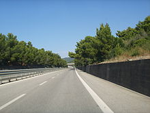
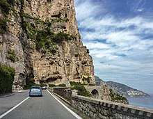
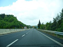
In order for a road to be classified as an autostrada, various geometric and construction conditions must be satisfied and these, although very similar in basis (for example the width of the travel lanes must be 3.75 m (12.3 ft)) are not constant: there are different technical-legal regulations for motorways built in urban or extra-urban areas.
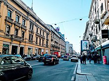
Italian traffic code (Codice della strada) divides extra-urban dual carriageways into two different classifications:[40] These are the roads present within inhabited centers.
State highways that cross towns with a population of at least 10,000 inhabitants are urban roads (type D and E) under the jurisdiction of the relevant comuni.
The state highway that cross towns or villages with a population of less than 10,000 inhabitants are urban roads (type D and E) under the jurisdiction of the comune, subject to authorization from ANAS.
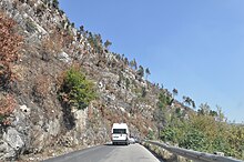
[42] The Italian state highway network has approximately 25,000 km (16,000 mi) of roads identified with the acronym SS.
Due to urbanization processes, it has abandoned some sections of state highways, following the their acquisition by the interested comuni, who now take care of their maintenance.
Starting from the mid-1960s, ANAS also began to build a network of dual carriageways which often flanked or completed the routes of the state highways, but did not formally replace them.
The urban sections of state, regional or provincial roads that pass through towns with fewer than 10,000 inhabitants are not municipal.
[54] It was initially classified as a motorway, but following the decree of 22 July 1989, responsibilities were transferred to Anas, which included the route in the itinerary of the state road 225 of Val Fontanabuona.
In 1984, by ministerial decree of 20 July 1983, some motorway junctions, already open, forming part of the Italian trunk roads, were defined and classified as such.
They are regulated by the Codice della Strada (Italian traffic code) and by the Regolamento di Attuazione del Codice della Strada (Rules for the Implementation of the Italian traffic code) in conformity with the 1968 Vienna Convention on Road Signs and Signals.
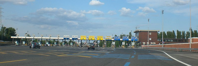
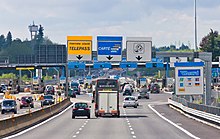
[63] From a technical point of view, however, the mixed barrier/free-flow system is active where, at the entrance and exit from the motorways, there are lanes dedicated to the collection of a ticket (on entry) and the delivery of the ticket with simultaneous payment (on exit) and other lanes where, during transit without the need to stop, an electronic toll system[64] present in the vehicles records the data and debits the toll, generally into the bank account previously communicated by the customer, to the manager of his device.
[65] It requires the driver of the vehicle to collect a special ticket at the entrance to the motorway and pay the amount due upon exit.
Motorway barriers are arranged along the route (however not at every junction), at which the user pays a fixed sum, depending only on the class of the vehicle.
The names of municipal roads within inhabited centers are shown on rectangles, standardized by the Italian traffic code, with a white background (except for local specificities, such as the Venetian nizioleti).
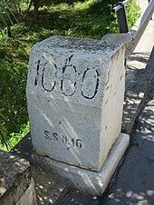
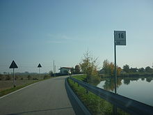
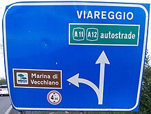
In Italy the highway location marker is a square white sign with the current kilometer (of hectometer) of the road written on it.