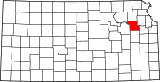
Shawnee County, Kansas
Shawnee County is located in northeast Kansas, in the central United States.
For many millennia, the Great Plains of North America was inhabited by nomadic Native Americans.
In 1802, Spain returned most of the land to France, but keeping title to about 7,500 square miles.
In 1803, most of the land for modern day Kansas was acquired by the United States from France as part of the 828,000 square mile Louisiana Purchase for 2.83 cents per acre.
Westward expansion brought the country its first white settler in 1830 when Frederick Choteau opened a trading post on American Chief (now Mission) Creek.
Topeka was made the county seat by popular vote in 1858, and a new courthouse was built at 4th Street and Kansas Avenue in 1867.
In 1896, a new larger courthouse was constructed at 5th and Van Buren, with more than 50,000 residents then living in the county.
When the county was formed in 1855, it was bounded by the Kansas River on the north, and the southern boundary was nine miles (14 km) further south.
The present northern line (six miles north of the second standard parallel) was established in 1868.
[7] The Kansas River runs east across the county, just north of the center, being bordered on its north bank by the townships of Rossville, Silver Lake, Menoken, and Soldier, and on its south bank by the townships of Dover, Mission, and Tecumseh.
Coal is found in detached and non-continuous beds, and is mined in a small way for local purposes in Topeka, Soldier and Menoken.
Along the western border the landscape is hilly with the Flint Hills a few miles further west in Wabaunsee County.
The growth consists of elm, cottonwood, black walnut, oak, sycamore, box elder, hickory and ash.
It occupies over ten percent of the county's land area and ranks fourth in population among all cities in Kansas.
The formation of the townships of Topeka (1857) and Monmouth (1860) reduced Tecumseh Township to its current greatest extent of about seven miles (11 km) from north to south from the Kansas River and less than seven miles (11 km) from east to west from the county's eastern border.
Small portions in the western part have been annexed by the city of Topeka, and its present area is 36 square miles (93 km2).
Richland, which was in the township's far southeast corner, was purchased by the U.S. Army Corps of Engineers in the late 1960s as a part of the land acquired for Clinton Lake.
It contains the towns of Wakarusa and Cullen Village and the greater portion of Forbes Field (airport).
Auburn Township, 56 square miles (150 km2) in area, occupies the county's southwestern corner.
The township and city were named for William W. Ross, the brother of Senator Edmund G.
Shawnee County is included in the Topeka Metropolitan Statistical Area, which had an estimated population of 232,670 in 2021.
From Bob Dole in 1996 to 2016, Republicans carried the county with a plurality, with the sole exception being George W. Bush in his 2004 reelection bid.
In 2020, Biden won Shawnee by a 3% margin, the first Democratic victory in the capital county in 28 years.
In 2024, Donald Trump became the first Republican to win a presidential election without carrying Shawnee.
[30] The county voted "No" on the 2022 Kansas abortion referendum, an anti-abortion ballot measure, by 66% to 34%, outpacing its narrow support of Joe Biden during the 2020 presidential election.
Forbes Field Air National Guard base and airport is south of Topeka, near Pauline.
† means a community is designated a Census-Designated Place (CDP) by the United States Census Bureau.
As a city of the first class, Topeka is considered governmentally independent and is excluded from the census figures for the townships.

