Stone County, Arkansas
Stone County occupies 609.43 square miles (1,578.4 km2) and contained a population of 12,359 as of the 2020 Census.
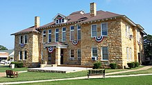
The county is roughly split along an east–west line near Mountain View, the centrally located county seat,[4] with areas north within the Springfield Plateau, and areas south within the Boston Mountains.
Areas along the White River, which forms the county's northeastern boundary, are dissected bluffs of the Salem Plateau rather than riparian floodplains.
As of the 2020 United States census, there were 12,359 people, 4,787 households, and 3,109 families residing in the county.
Former newspapers include the Stone County Democrat and Mountain View Herald (1932-1953).
The quorum court is the legislative branch of the county government and controls all spending and revenue collection.
Representatives are called justices of the peace and are elected from county districts every even-numbered year.
[20][21] Property tax is assessed by the Stone County Assessor annually based upon the fair market value of the property and determining which tax rate, commonly called a millage in Arkansas, will apply.
This tax is collected by the Stone County Collector between the first business day of March of each year through October 15 without penalty.
Within Stone County, the City of Mountain View has had an additional 2% sales and use tax since September 1, 2005.
In Congress, Arkansas has been represented by two Republican senators (John Boozman and Tom Cotton) since January 3, 2015, ending a long history of Democratic hegemony.
[4] Stone County has dozens of unincorporated communities and ghost towns within its borders.
This is due to early settlers in Arkansas tending to settle in small clusters rather than incorporated towns.
For example, communities like Newnata had a post office and dozens of buildings at some point in their history.
Other communities are simply a few dwellings at a crossroads that have adopted a common place name over time.
Each township includes unincorporated areas; some may have incorporated cities or towns within part of their boundaries.
However, the United States census does list Arkansas population based on townships (sometimes referred to as "county subdivisions" or "minor civil divisions").
Each town or city is within one or more townships in an Arkansas county based on census maps and publications.
Also known as Harry E. Wilcox Memorial Field, the facility is a small, rural general aviation airport with 5,650 annual operations.
The two routes briefly form a concurrency, or overlap, between Mountain View and Allison.
Highway 382 serves as an access for Ozark Folk Center State Park.
[29] The Arkansas Department of Health (ADH) is responsible for the regulation and oversight of public water systems throughout the state.
Mountain View has the largest direct retail population served (7,295, all in Stone County), followed by West Stone County (4,634, including customers served in adjacent counties), Pleasant Grove Water Association (2,315), and Richwoods Water Association (1,436), with the remaining systems under 600 retail population served.