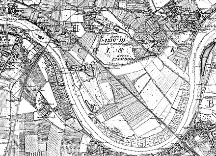
Little Sutton, Chiswick

[2][3] It was a Crown holding in the 14th and 15 centuries; in 1396, king Richard II built a royal residence here, complete with a chapel, a hall, and a moat.

[2][3][4] By 1589 the great house was accompanied by farm buildings, a malthouse, and a gatehouse, with 3 acres of gardens and orchards.

[2] The field around the old moated enclosure was called Berry-gates until at least 1818. for "gated burh", a fortified place; the name survives in the nearby Barrowgate Road.

[2][3] Little Sutton was never more than a small hamlet without a church; by 1703 there were some almshouses, and there appears to have been an inn named the Queen's Head, documented in 1722 and 1862 (if they were the same building).

[6][7] The village inn, the Queen's Head, now called the Hole in the Wall, is on Sutton Lane North, just across the A4.

Little Sutton area on Ordnance Survey map, c. 1880. Little Sutton is top centre; Kew Bridge and Strand-on-the-Green top left; Chiswick House and Gardens top centre right, and Old Chiswick top right. Grove House and its Park are centre left between the river and the railway leading to Barnes Railway Bridge . A broad strip beside the river is marked as marsh; much of the peninsula is shown as orchard (arrays of dots) or open fields.
Map of Sutton Court and Chiswick House by Peter Potter, 1818. Chiswick House is on the right in its landscaped grounds (dark green); the "river" (blue) is the remodelled Bollo Brook, and Fauconberg's "The Park" (white), acquired by Burlington for Chiswick House below it. Sutton Court is left centre, the old moated house enclosure to its north, and its fields just across the curving lane (now Fauconberg Road).