Tropical Storm Barry (2007)
The second named storm of the 2007 Atlantic hurricane season, Barry developed from a trough of low pressure in the southeastern Gulf of Mexico on June 1.
It tracked rapidly northeastward, reaching peak winds of 60 mph (97 km/h) before weakening and making landfall near Tampa Bay as a tropical depression.
Barry quickly lost tropical characteristics after wind shear removed much of the convection, and early on June 3, it completed the transition into an extratropical cyclone.
[2] A westward moving tropical wave spawned a broad area of low pressure on May 30, and by May 31, a circulation had developed within the system to the southeast of Cozumel, Mexico.
[4] The deep convection became more concentrated near the center, and it is estimated the system developed into a tropical depression at 12:00 UTC on June 1, just to the northwest of the western tip of Cuba.
[6] Embedded within the southwesterly flow ahead of an approaching mid-level trough, it tracked quickly northward,[6] and early on June 2, Barry attained peak winds of 60 mph (97 km/h), with a minimum central pressure of 997 millibars (29.4 inHg).
[8] As the system continued inland, it rapidly lost tropical characteristics, and later that day the National Hurricane Center discontinued advisories on Barry, while it was located over northeastern Florida.
[9] The extratropical remnants strengthened, as the system continued northeastward, and on June 3, the storm moved ashore along the coast of South Carolina.
[10] Spiral bands developed to the north of the system as it moved up the coast, and a large plume of moisture extended well ahead of the low-level circulation.
[13] An inland tropical storm warning was also issued for non-coastal and non-tidal areas of Charlotte, Citrus, DeSoto, Hardee, Hernando, Highlands, Lee, Levy, Manatee, Pasco, Pinellas, Polk, Sarasota, and Sumter counties.
[17] The precursor system dropped heavy rainfall across western Cuba, peaking at 12.0 inches (300 mm) in Sancti Spíritus Province.
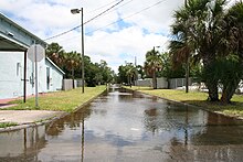
The increased ocean action caused minor flooding along several roads in the Tampa Bay area,[24] which trapped some automobile travelers.
[11] The precipitation assisted firefighters in combating wildfires in the southern portion of the state, which gave thousands of workers a brief respite after they had fought the fires daily for over a month.
[31] The extratropical remnants of Barry produced gusty winds along the Atlantic coastline which peaked at 60 mph (97 km/h) near Charleston, South Carolina.
[23] The remnants of Tropical Storm Barry contributed to heavy rainfall and flooding in the Finger Lakes region of New York State.

Tropical storm (39–73 mph, 63–118 km/h)
Category 1 (74–95 mph, 119–153 km/h)
Category 2 (96–110 mph, 154–177 km/h)
Category 3 (111–129 mph, 178–208 km/h)
Category 4 (130–156 mph, 209–251 km/h)
Category 5 (≥157 mph, ≥252 km/h)
Unknown