Typhoon Nangka (2015)
Nangka started its long-living journey as a tropical disturbance over the Marshall Islands and west of the International Dateline, becoming the eleventh named storm of the annual typhoon season on July 3.
[3] At 18:00 UTC on July 2, the Japan Meteorological Agency (JMA) classified the system as a tropical depression, about 80 km (50 mi) east of Aur Atoll.
[4] Based on the increasing organization, the Joint Typhoon Warning Center (JTWC) classified the system as Tropical Depression 11W at 12:00 UTC on July 3.
[4] When Nangka was upgraded to a tropical storm by the JTWC early on July 4, convective bands were wrapping into the center, but limited by dry air to the west.
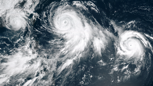
[7] On July 6 after shear diminished, Nangka began to quickly intensify as it developed an eye in the center of the blossoming convection.
[4] Nangka reached its first peak intensity at 12:00 UTC on July 7, when JMA estimated 10 minute sustained winds 185 km/h (115 mph).
[4] The typhoon was aided by excellent radial outflow enhanced by a TUTT cell to the northwest, and it developed a well-defined eye 48 km (30 mi) in diameter.
[9] After reaching its initial peak intensity, Nangka slightly weakened as convection along the west side of the system was restricted due to the TUTT cell, and the eye became cloud-filled.
[10] Decreasing wind shear and increasing sea surface temperatures allowed the intensification trend to resume, and the structure became more symmetric late on July 8 as it moved toward the Northern Marianas Islands.
[12] On July 9, the JTWC upgraded Nangka to a Category 4-equivalent super typhoon, estimating peak 1 minute winds of 250 km/h (155 mph).
[22] At 14:00 UTC on July 16, Nangka made landfall along the Japanese island of Shikoku near Muroto, Kōchi, still at typhoon status.
[23] Four hours later, the typhoon weakened into a severe tropical storm,[4] and after crossing the Seto Inland Sea, Nangka made a second landfall on Honshu near Kurashiki, Okayama at 21:00 UTC.
[23] The convection greatly weakened as it crossed Honshu into the Sea of Japan,[24] and the storm deteriorated further due to lower water temperatures.
[25] At 12:00 UTC on July 17, the JMA downgraded Nangka to a tropical depression,[4] and early the next day the JTWC discontinued advisories.
[32] The outskirts of the storm later brushed the east coast of South Korea,[33] producing 26 mm (1.0 in) in rainfall, and wind gusts of 93 km/h (58 mph).
[43] Across Japan, strong waves and high winds killed over 11,000 bluefin tuna on a fish farm in Kushimoto, accounting for ¥1.29 billion (US$10.4 million) in losses.

Tropical storm (39–73 mph, 63–118 km/h)
Category 1 (74–95 mph, 119–153 km/h)
Category 2 (96–110 mph, 154–177 km/h)
Category 3 (111–129 mph, 178–208 km/h)
Category 4 (130–156 mph, 209–251 km/h)
Category 5 (≥157 mph, ≥252 km/h)
Unknown