Typhoon Nanmadol (2004)
The typhoon later became the first December tropical cyclone to strike Taiwan since record keeping began, bringing along with it heavy rain, which also affected nearby regions of eastern China.
Quickly pacing towards the north-northwest about the periphery of a nearby subtropical ridge, Nanmadol reached its peak intensity on December 1 with winds of 165 km/h (103 mph) and a minimum barometric pressure of 935 mbar (hPa; 27.61 inHg).
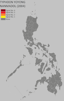
[nb 1] Shortly after, the typhoon made landfall at a similar intensity on Casiguran, Aurora, quickly moving over Luzon before reaching the South China Sea, where it recurved northward into hostile atmospheric conditions.
With the typhoon approaching landfall in an area still recovering from previous storms, relief agencies already servicing the region were forced to allocate additional resources to prepare for Nanmadol.
With convection consolidating about a potential center of circulation,[1] the Japan Meteorological Agency (JMA) classified the broad system as a tropical depression the following day.
Tracking northwestward due to the presence of a nearby subtropical ridge to its north,[1] the depression continued to strengthen, reaching tropical storm intensity on November 29 while 860 km (530 mi) south-southeast of Guam.
[1] Conducive atmospheric conditions around Nanmadol on November 29 led to the development of a central dense overcast, followed shortly thereafter by the formation of an eye.
[1] Nanmadol was upgraded to severe tropical storm intensity at 0000 UTC on November 30 and became a typhoon twelve hours later,[2] tracking near Satawal, Woleai, and Yap State during this intensification phase.
At 0600 UTC on December 1, Nanmadol reached peak intensity with maximum sustained winds of 165 km/h (103 mph) and a minimum barometric pressure of 935 mbar (hPa; 27.61 inHg), still east of the Philippines.
[4] Due to the rapid motion of Nanmadol, the typhoon crossed Luzon in under six hours, emerging into the South China Sea before 1800 UTC on December 2.
[2] Though land interaction with the Philippines did not significantly affect the cyclone, a shortwave trough forced Nanmadol to sharply curve northward, bringing it into hostile atmospheric conditions within the Luzon Strait.
[2] Increased wind shear and the advection of dry air further weakened the tropical cyclone, and by midday on December 3, the storm's center of circulation became decoupled from the rest of the convection.
[1] At 2340 UTC that day, Nanmadol made landfall near Fangliao, Pingtung in Taiwan, becoming the first December tropical cyclone to strike the island in 108 years of record-keeping.
Some commercial flights traversing to and from Luzon were cancelled in addition to ferry service between the eastern Bicol Region and Manila, stranding hundreds of passengers.
[8] President Gloria Macapagal Arroyo ordered for precautionary measures to be undertaken by agencies under the purview of the National Disaster Coordinating Council (NDCC).
[16] Other evacuees sought refuge in well-constructed buildings, as was the case in Mercedes, Eastern Samar, where 2,000 civilians stayed inside a school.
Potential impacts, which would likely be enhanced by the East Asian Monsoon, prompted Taiwanese president Chen Shui-bian to postpone political marches and campaign rallies intended for the upcoming presidential elections.
A navy gunboat refitted as a relief ship headed for Real, Quezon was forced to turn back due to high waves onset by the approaching typhoon which swept potentially hazardous logs into sea.
[26] In the aftermath of the typhoon, the Philippine Red Cross made a full emergency appeal for funding to assist in recovery from Nanmadol and preceding storms.

Tropical storm (39–73 mph, 63–118 km/h)
Category 1 (74–95 mph, 119–153 km/h)
Category 2 (96–110 mph, 154–177 km/h)
Category 3 (111–129 mph, 178–208 km/h)
Category 4 (130–156 mph, 209–251 km/h)
Category 5 (≥157 mph, ≥252 km/h)
Unknown