U.S. Route 50 in Maryland
[1][2][3] The 9.17-mile (14.76 km) western segment is a two-lane undivided road through rural mountain areas in Garrett County, heading into West Virginia at both ends.
From here, US 50 becomes an at-grade divided highway called Ocean Gateway and runs through rural areas of the Eastern Shore, heading south through Easton to Cambridge.
The route heads southeast from the state line as a two-lane undivided road that passes through a mix of farmland and woods with some homes.
The route passes some development at the summit, which is the highest point in the Maryland state highway system at an elevation of 3,095 feet (943 m), before it descends the mountain, curving to the east.
US 50 reaches an intersection with the southern terminus of MD 560 in Gorman and turns east to come to a bridge over CSX's Thomas Subdivision railroad line and the North Branch Potomac River.
US 50 continues through suburban areas alongside the railroad tracks, passing near the Landover station along the Orange Line that can be accessed from MD 202.
Past this interchange, the freeway turns east and passes over Amtrak's Northeast Corridor and Washington Metro's Orange Line.
Farther east, the route runs through wooded areas with more scattered residential development, heading to the north of Freeway Airport.
The road turns to the northeast and comes to a bridge over CSX's Pope's Creek Subdivision railroad line before it crosses into Bowie and reaches the MD 197 exit, which is a partial cloverleaf interchange.
[1][3] Upon crossing the Patuxent River, US 50/US 301 and unsigned I-595 head into Anne Arundel County and continue through wooded areas with some farm fields, bending to the east-northeast.
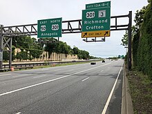
The freeway curves to the east and heads near more dense residential development before it reaches a directional T interchange with the southern terminus of I-97, which leads north toward Baltimore.
[1][3] The route passes under MD 436 and runs near residential neighborhoods before crossing over the Severn River on the Pearl Harbor Memorial Bridge.
Past this interchange, US 50/US 301 become Blue Star Memorial Highway and pass to the south of Arnold, coming to a westbound right-in/right-out (RIRO) intersection serving MD 648 and continuing northeast through wooded areas with some businesses adjacent to the road.
The road runs through more woodland with some homes before it turns southeast and comes to a modified cloverleaf interchange with Oceanic Drive (MD 908D) in Skidmore that provides access to Sandy Point State Park to the east.
The route turns due south and comes to an intersection with MD 404, which heads west to Wye Mills and east to provide access to Denton and, along with DE 404, the Delaware Beaches.
Following this intersection, the road crosses an abandoned railroad grade owned by the Maryland Department of Transportation before the median of the route narrows again and it passes through a mix of farm fields and commercial development.
The road widens to six lanes and becomes lined with businesses as it heads through the eastern part of Easton, coming to an intersection with the western terminus of MD 328.
[3][9] After passing over the Choptank River on the Senator Frederick C. Malkus Bridge, US 50 enters Cambridge in Dorchester County and becomes Sunburst Highway, a six-lane divided road that is lined with businesses, heading to the east of the downtown area.
The route continues through rural land, with Maiden Forest Road looping to the north and the highway making a turn to the southeast.
Following this, the road passes over MD 331 and an abandoned railroad right-of-way owned by Delmarva Power and Light Company before it heads through fields to the south of a lake, curving to the southeast.
US 50 continues through a mix of farmland and woodland with some residential and commercial development, turning to the east as it passes north of a roadside picnic area.
[1][3] US 50 continues east along Ocean Gateway, a four-lane, at-grade divided highway with a wide median, and passes to the north of Arthur W. Perdue Stadium, the home ballpark of the Delmarva Shorebirds baseball team.
[1][3] After passing over the Pocomoke River, US 50 enters Worcester County and runs through more wooded areas before coming to an intersection with MD 610, which heads north to Whaleyville.
The route comes to an eastbound exit and westbound entrance with the western terminus of MD 90, a two-lane expressway that provides access to the northern part of Ocean City.
The route runs through more agricultural areas with some businesses and passes north of Stephen Decatur High School as it comes to a junction with the southern terminus of MD 452.
[1][3] Past the creek, the route intersects another section of MD 707 that heads southeast near the Greater Ocean City Chamber of Commerce visitor center.
The road curves to the east-southeast and has a junction with the northern terminus of MD 611, which heads south to provide access to the Ocean City Municipal Airport and Assateague Island.
[1][3] Heading west on US 50 out of Ocean City, an overhead mileage sign lists the distance to the western terminus of the route in Sacramento, California, as 3,073 miles (4,946 km).
[21] In August 2010, the Maryland State Highway Administration announced plans to construct a new drawbridge over the Sinepuxent Bay to replace the current high rise structure.
Significant environmental and economic impacts were identified, with a report stating that any additional crossing is "expected to be multiple billions of dollars.