Amazon River
There is ample evidence that the areas surrounding the Amazon River were home to complex and large-scale indigenous societies, mainly chiefdoms who developed towns and cities.
[40]: 25 Because of the terra preta, indigenous communities were able to make land fertile and thus sustainable for the large-scale agriculture needed to support their large populations and complex social structures.
Gonzalo Pizarro set off in 1541 to explore east of Quito into the South American interior in search of El Dorado, the "city of gold" and La Canela, the "valley of cinnamon".
Based on intelligence received from a captive native chief named Delicola, they expected to find food within a few days downriver by ascending another river to the north.
[44] From 1648 to 1652, Portuguese Brazilian bandeirante António Raposo Tavares led an expedition from São Paulo overland to the mouth of the Amazon, investigating many of its tributaries, including the Rio Negro, and covering a distance of over 10,000 km (6,200 mi).
In what is currently in Brazil, Ecuador, Bolivia, Colombia, Peru, and Venezuela, several colonial and religious settlements were established along the banks of primary rivers and tributaries for trade, slaving[citation needed] , and evangelization among the indigenous peoples of the vast rainforest, such as the Urarina.
[48] On 6 September 1850, Emperor Pedro II of Brazil sanctioned a law authorizing steam navigation on the Amazon and gave the Viscount of Mauá (Irineu Evangelista de Sousa) the task of putting it into effect.
The success of the venture called attention to the opportunities for economic exploitation of the Amazon, and a second company soon opened commerce on the Madeira, Purús, and Negro; a third established a line between Pará and Manaus, and a fourth found it profitable to navigate some of the smaller streams.
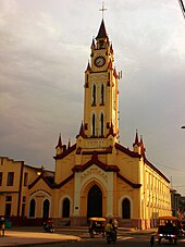
[48] Thanks in part to the mercantile development associated with steamboat navigation coupled with the internationally driven demand for natural rubber, the Peruvian city of Iquitos became a thriving, cosmopolitan center of commerce.
By the turn of the 20th century, the exports of the Amazon basin were India-rubber, cacao beans, Brazil nuts and a few other products of minor importance, such as pelts and exotic forest produce (resins, barks, woven hammocks, prized bird feathers, live animals) and extracted goods, such as lumber and gold.
Since colonial times, the Portuguese portion of the Amazon basin has remained a land largely undeveloped by agriculture and occupied by indigenous people who survived the arrival of European diseases.
The original architect of this expansion was president Getúlio Vargas, with the demand for rubber from the Allied forces in World War II providing funding for the drive.
A 2014 study by Americans James Contos and Nicolas Tripcevich in Area, a peer-reviewed journal of the Royal Geographical Society, however, identifies the most distant source of the Amazon as actually being in the Río Mantaro drainage.
From this point to the confluence of the Ucayali and the Marañón, some 1,600 km (990 mi), the forested banks are just above the water and are inundated long before the river attains its maximum flood stage.
The river systems and flood plains in Brazil, Peru, Ecuador, Colombia, and Venezuela, whose waters drain into the Solimões and its tributaries, are called the "Upper Amazon".
These include rivers Putumayo, Caquetá, Vaupés, Guainía, Morona, Pastaza, Nucuray, Urituyacu, Chambira, Tigre, Nanay, Napo, and Huallaga.
[62] From the town of Canaria at the great bend of the Amazon to the Negro, vast areas of land are submerged at high water, above which only the upper part of the trees of the sombre forests appear.
In the lower reaches of the river, the north bank consists of a series of steep, table-topped hills extending for about 240 km (150 mi) from opposite the mouth of the Xingu as far as Monte Alegre.
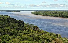
The Pará and the Amazon are connected by a series of river channels called furos near the town of Breves; between them lies Marajó, the world's largest combined river/sea island.
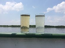
The plume generated by the river's discharge covers up to 1.3 million km2 and is responsible for muddy bottoms influencing a wide area of the tropical north Atlantic in terms of salinity, pH, light penetration, and sedimentation.
[4][5] In July 2008, the Brazilian Institute for Space Research (INPE) published a news article on their webpage, claiming that the Amazon River was 140 km (87 mi) longer than the Nile.
In June 2007, Guido Gelli, director of science at the Brazilian Institute of Geography and Statistics (IBGE), told London's Telegraph Newspaper that it could be considered that the Amazon was the longest river in the world.
The fresh water, being lighter, flows on top of the seawater, diluting the salinity and altering the colour of the ocean surface over an area up to 2,500,000 km2 (970,000 sq mi) in extent.
The proto-Amazon during the Cretaceous flowed west, as part of a proto-Amazon-Congo river system, from the interior of present-day Africa when the continents were connected, forming western Gondwana.
The rise of the Andes and the linkage of the Brazilian and Guyana bedrock shields,[clarification needed] blocked the river and caused the Amazon Basin to become a vast inland sea.
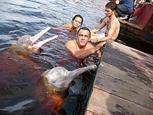
The bull shark (Carcharhinus leucas), a euryhaline species which can thrive in both salt and fresh water, has been reported as far as 4,000 km (2,500 mi) up the Amazon River at Iquitos in Peru.
The Amazon River serves as a vital lifeline for more than 47 million people in its basin and faces a multitude of challenges that threaten both its ecosystem and the indigenous communities dependent on its resources.
According to the Office of the United Nations High Commissioner for Human Rights (OHCHR), the Yanomami, a tribe of approximately 29,000, struggles to preserve their land, culture, and traditional way of life due to encroaching illegal gold miners, malnutrition, and malaria.
Meanwhile, in 2022, the region's severe drought, has led to a devastating increase in water temperatures, reaching 39.1 degrees Celsius, causing the demise of 125 Amazon river dolphins.
Brazil, the primary custodian of this invaluable natural resource, grapples with the challenges of mitigating the effects of this drought on communities and ecosystems, further emphasizing the urgency of sustainable environmental management and conservation efforts.