List of primary state highways in Virginia shorter than one mile
State Route 34 is the designation for Hodges Street, which runs 0.54 miles (870 m) from SR 129 east to US 360 within the town of South Boston.
Parham Road is a four-lane divided highway that passes along the west and north side of Richmond from SR 150 near the James River to US 301 just south of I-295.
[5] State Route 79 is the designation for Apple Mountain Road, a 0.23-mile (370 m) connector between SR 55 and a diamond interchange with I-66 in Linden.
[1][8] State Route 109 is the designation for Hickory Hill Road, which runs 0.91 miles (1,460 m) from US 460 east to an extrance to Fort Gregg-Adams within the city of Petersburg.
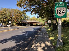
[1][10] State Route 124 is the designation for the 0.17-mile (900 ft; 270 m) state-maintained segment of Spout Run Parkway between US 29 and Lorcom Lane in Arlington.
[1][15] State Route 148 is the designation for the 0.87-mile (1,400 m) section of Chances Creek Road from I-77 east to US 52 near Fancy Gap.
[1][16] State Route 162 is the designation for the 0.17-mile (900 ft; 270 m) section of Second Street between the east city limit of Williamsburg and SR 143 in York County.
Known as Gateway Crossing, the road was completed in December 2016 as part of a project to ease congestion around the intersection of Interstate 81 (I-81), U.S. Route 220 Alternate (US 220 Alt.)
SR 188 continues north on McCormick Boulevard to Lafayette Street, which the state highway follows one block west.
[1][20] State Route 196 is the designation for the 0.96-mile (1,540 m) portion of Canal Drive from Military Highway, which carries US 13 and US 460, north to US 17 near the Deep Creek area of the city of Chesapeake.
The state highway is entirely elevated from US 1 to its eastern terminus between CSX's RF&P Subdivision and the George Washington Memorial Parkway.
The state highway, which has a length of 0.61 miles (980 m) between the east and north town limits of Dayton, also follows a small piece of Huffman Drive and has a short concurrency with SR 42 Business.
[1][37] State Route 304 is the designation for Seymour Drive, which runs 0.71 miles (1,140 m) from US 501 east to US 360 north of and parallel to the Dan River within the town of South Boston.
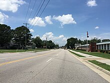
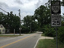
[1][38] State Route 306 is the designation for the 0.88-mile (1,420 m) segment of Harpersville Road from US 60 east to US 17 and SR 143 within the city of Newport News.
[42] State Route 380 is the designation for Elko Tract Road, a 0.34-mile-long (550 m) connector between Technology Boulevard and SR 156 in eastern Henrico County near Sandston.
[43][44] The route runs on the site of the Elko Tract, a former ghost town and World War II decoy city now being converted to an industrial park.
Princess Anne Road continues west as a city street through the Ghent neighborhood and east as SR 166.
King Boulevard from US 60 Pocahontas Trail to Eastern Region, Virginia Forestry Service near Providence Forge in New Kent County.