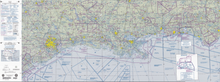
World aeronautical chart
WACs show topographic information, airports and radio navigational aids.
Unlike sectional charts, North American WACs are named according to an international "grid system" having a combination of letters and numbers.
On June 23, 2015, FAA officially stopped providing the World Aeronautical Chart due to a decline in interest and technological advances.
Charts: CH–25; CJ–26, and CJ–27 production ended upon their next scheduled printing dates of December 10, 2015; February 04, 2016, and March 31, 2016 respectively.
[1] Source: FAA Pilot's Handbook This cartography or mapping term article is a stub.