2011 Mississippi River floods
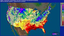
In April 2011, two large storm systems deposited record levels of rainfall on the Mississippi River drainage basin.
U.S. President Barack Obama declared the western counties of Kentucky, Tennessee, and Mississippi federal disaster areas.
[6] For the first time in 37 years, the Morganza Spillway was opened on May 14, deliberately flooding 4,600 square miles (12,000 km2) of rural Louisiana to save most of Baton Rouge and New Orleans.
[17] From April 14–16, the storm system responsible for one of the largest tornado outbreaks in U.S. history also produced large amounts of rainfall across the southern and midwestern United States.
[18] The unprecedented extensive rainfall from these four storms, combined with springtime snow melt from the Upper Midwest, created the perfect situation for a 500-year flood along the Mississippi.
On May 3, using the planned procedures for the Birds Point-New Madrid Floodway, the Corps of Engineers blasted a two-mile (3 km) hole in the levee protecting the floodway, flooding 130,000 acres (530 km2) of farmland in Mississippi County, Missouri, in an effort to save the town of Cairo, Illinois and the rest of the levee system, from record-breaking flood waters.
The hotel portion of the casinos are located on adjacent, low-lying land, and began to flood with the rising waters, some up to 6 feet (1.8 m).
[33] On May 14, a single floodgate of the Morganza Spillway was opened in order to divert 125,000 cubic feet per second (3,500 m3/s) of water from the Mississippi River to the Atchafalaya Basin.
Following this analysis, which showed that extensive flooding was expected in the Atchafalaya Basin regardless of the choice made regarding the Morganza Spillway, the Corps decided to start the 2011 diversion by opening the spillway a bit less than described in scenario 1a (21%, not 25%)[34] The Corps of Engineers subsequently released a map showing the estimated times it would take the flood waters to reach the various communities in the Atchafalaya Basin over eight days.
[44] The Gravity Recovery and Climate Experiment (GRACE) satellites indicated a continued water storage increase over the Missouri River Basin (MRB) prior to the 2011 flood event.
The results infer a prominent teleconnection forcing in driving the wet/dry spells in the MRB, and this connection implies persistence of dry conditions for the next 2 to 3 years.