Active fault
[2] Various geologic methods are used to define the boundaries of an active fault such as remote sensing and magnetic measurements, as well as other ways.
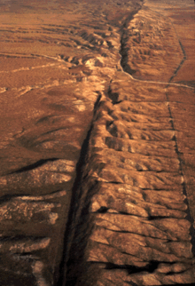
Several types of data, such as seismologic reports or records over time, are used to gauge fault activity.
Activity and fault area are correlated, and risk analysis is employed with other factors to determine the potential earthquake hazard.
[2] The geologic conditions and plate tectonic setting in much of the Western U.S. has resulted in the region being underlain by relatively thin crust and having high heat flow, both of which can favor relatively high deformation rates and active faulting.
Furthermore, the CEUS is thousands of miles from active plate boundaries, so the rates of deformation are low in this region.