Apurímac River
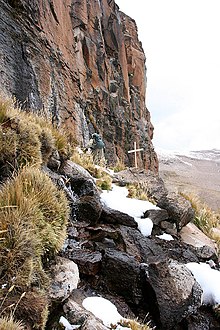
The Apurímac River (Quechua: Apurimaq mayu IPA: [ˈapʊ ˈɾɪmaχ ˈmajʊ]; Spanish: río Apurímac, IPA: [ˈri.o apuˈɾimak]; from Quechua apu 'chief' and rimaq 'the one who speaks, oracle', thus 'the chief oracle') rises from glacial meltwater of the ridge of the Mismi, a 5,597-metre-high (18,363 ft) mountain in the Arequipa Province in the south-western mountain ranges of Peru, 10 km (6.2 mi) from the village Caylloma, and less than 160 km (99 mi) from the Pacific coast.
It flows generally northwest past Cusco in narrow gorges with depths of up to 3,000 m (9,800 ft), almost twice as deep as the Grand Canyon, its course interrupted by falls and rapids.
Of the six attempts to travel the full length of the Apurímac so far, only two have been successful.
Sometimes the complete river from its source to its junction with the Ucayali, including the rivers Ene and Tambo, is called "Apurímac", with a total length of 1,070 km (660 mi).
In the 13th century, the Inca constructed a bridge over this river which gave them access to the west.