Australian east coast low
[6][7][8] Prior to the introduction of satellite imagery in the early 1960s, many east coast lows were classified as tropical cyclones.
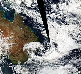
[9] Generally, the low occurs when there exists a temperature contrast between the warmer Tasman Sea and cooler continental landmass (including the cold air in the upper atmosphere), a setup similar to the lake-effect rain.
[11] An east coast low can develop in a variety of other weather conditions, including: Explosive cyclogenesis is seen on average just once per year, but these storms cause significant wind and flood damage when they occur.
[11] Australian east coast cyclones, although variable in size and intensity, are typically characterised by widespread heavy rainfall.
[16] More powerful systems may percolate inland into the Central Tablelands, New England, the Central West, South Western Slopes, the Monaro and, albeit rarely, the Orana and the Riverina regions in NSW; also the Australian Capital Territory, the Hume region in Victoria; as well as Darling Downs and the Brigalow Belt in Queensland, although the rainfall in these interior areas will often be insignificant.
[9] In a June 2007 observation by the Bureau of Meteorology, there were about ten significant maritime lows with an "explosive development" usually occurring once per year.
[4] Another feature of east coast low development is the tendency for clustering of events when conditions remain favourable.