Gowensville, South Carolina
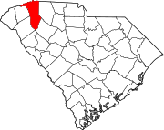
Gowensville is an unincorporated community in Greenville County, South Carolina, United States.
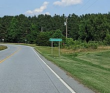
[1] The community sits along the Cherokee Foothills Scenic Highway and South Carolina Highway 14, flanking the Spartanburg County border to its east.
In 1780, during the American Revolutionary War, a skirmish between Loyalist and Patriot forces occurred at Gowen's Fort, named for soldier John "Buck" Gowen, the namesake of the town of Gowensville.
[2] A band of Loyalists and Chickamauga Cherokee, commanded by Captain William Bates, approached the area in an attempt to siege the Patriot stronghold.
[4] The locale is considered part of the informal region known as the "Dark Corner", which represented a safe haven for political dissenters and moonshiners in South Carolina throughout the 1800s.