Eglinton Avenue
Eglinton Avenue is a major east–west arterial thoroughfare in Toronto and Mississauga in the Canadian province of Ontario.
The street begins at Highway 407 (but does not interchange with the tollway) at the western limits of Mississauga, as a continuation of Lower Baseline in Milton.
Seeking to build new connections to the rapidly developing suburbs, Metro widened and interconnected Eglinton Avenue to its current form through the decade.
[4] In 1943, city planner Norman Wilson indicated the possible future need for a new urban highway to connect Eglinton Avenue with the Richview Sideroad.
[5] In Toronto, the right-of-way to construct the Richview Expressway remains but in the face of Local opposition the project has never come to fruition.
The only built part of the proposed Expressway are high-speed ramps from Eglinton Avenue to Highways 401 and 427 at a massive interchange near Renforth station.
The Eglinton West or "Little Jamaica" area, which stretches from Marlee Avenue / Winona Drive to Keele Street, is home to a number of Caribbean stores.
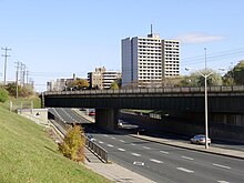
Eglinton Avenue is one of the few east–west routes north of Bloor Street that cross Toronto uninterrupted in a more or less straight line across the city.
The section between the Etobicoke Creek and Renforth Drive forms part of the city limits of Toronto and Mississauga.
The provincial government of Bob Rae started work on the Eglinton West line of the Toronto subway in 1994 as a way of appeasing politicians in Etobicoke and York who demanded rapid transit expansion in their constituencies after the city of North York successfully lobbied for the Sheppard line.
The Eglinton Crosstown LRT was unveiled as part of the TTC's Transit City light rail expansion program in 2007, which proposed an underground line to run from Jane Street to Laird Drive, with above ground sections running to Pearson International Airport in the west and to Kennedy station in Scarborough in the east.
[9] The redesign put the 19 kilometres (12 mi) Eglinton portion completely underground, integrated the Line 3 Scarborough portion (which has since been decommissioned due to age and the unavailability of new rolling stock), and would run contiguously from Black Creek Drive in the west to McCowan Road in the east.
Reconstruction between stations will be funded by the city and is proposed to be carried out after completion of the Crosstown line so that it does not interfere with the Metrolinx construction activity.
[10][11] A planning process called Eglinton Connects drew on public consultation to evaluate options for the redesign.