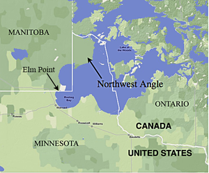
Elm Point, Minnesota
Elm Point, Minnesota, is a small uninhabited[2] cape and a practical exclave of the United States in Lake Township, Roseau County, Minnesota, United States.
It is surrounded on the west, south, and east by Lake of the Woods, and on the north by the Canadian First Nation community of Buffalo Point in southeastern Manitoba.
In addition to Elm Point, there are a few small parcels of land located west of Elm Point but east of the contiguous land mass of Minnesota that extend up to 300 feet (100 m) south of the border, making them U.S. territory.
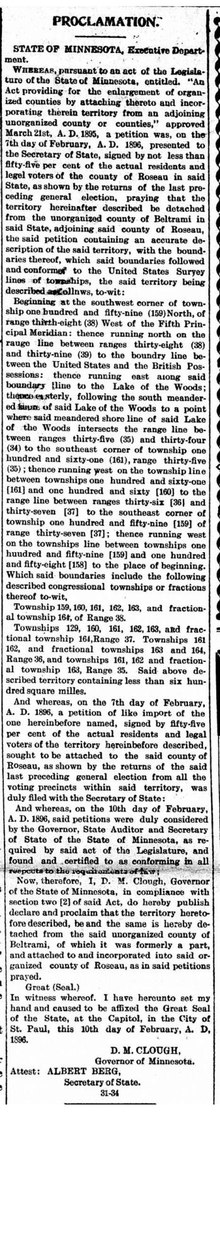
[11] The confusion appears to result from the wording of Governor David Marston Clough's proclamation dated February 10, 1896, which annexed the area to Roseau County.
The proclamation, however, states that the territory annexed includes the area of Township 164 North, Range 36 West, and that its boundaries "followed and conformed to the United States Survey lines of townships,"[1] as was required by law at the time.