Geography of Nova Scotia
Continental drift led to the southern half of the province's mainland portion, the Meguma terrane, once being attached to Africa whereas the Avalon terrane comprising the northern half, including Cape Breton Island, was once attached to Scandinavia and Scotland.
Nova Scotia's numerous hills, several low mountain ranges (the entire province is located within the Appalachian Mountains), lush river valleys, lakes and forests, windswept barrens, and a varied sea coast ranging from extremely rugged to broad sandy beaches, can be attributed to these forces.
Nova Scotia forms part of the southern shores of the Gulf of St. Lawrence and its sub-basin, the Northumberland Strait.
The Atlantic coast of Nova Scotia has numerous offshore fishing banks which are submerged sections of the continental shelf.
Rising sea levels since glaciation have inundated many parts of the coastline, including these areas on the continental shelf, providing rich habitat for marine life, as well as defining other unique features such as various coastal islands, bays, harbours and the Bras d'Or Lake – an 1,100 square kilometres (420 sq mi) estuary that defines the central portion of Cape Breton Island.
Initially, settlement patterns in Nova Scotia were defined by water transportation routes for the Maritime Archaic Indian civilization, followed by their descendants, the Mi'kmaq Nation, who used coastal waters for seasonal marine fishing and rivers and lakes for freshwater fishing.
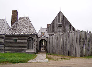
European discovery resulted in settlements in protected natural harbours and along shorelines where convenient trade routes for sailing ships provided reliable transportation to markets in Europe, New England and the Caribbean.
European settlers brought industrial fishing technologies and introduced large-scale forestry to sustain settlement construction and shipbuilding activities.
Wars between European military powers, notably Britain and France, resulted in various territorial claims and numerous defence works established along Nova Scotia's coastal settlements and inland trade routes.
The largest of these defensive installations was a French military fortified port at Louisbourg Harbour on Cape Breton Island.
The French territory of Acadia and New France finally fell permanently to Britain at the end of the Seven Years' War in 1763.
Under British control, Acadian farming settlements that had been abandoned under the Great Upheaval were populated by decommissioned soldiers and settlers brought from New England.
Foreign Protestants were actively recruited to settle Nova Scotia (which at that time included present-day New Brunswick) as the Empire's "Fourteenth Colony" in America.
Cape Breton Island was also created as a separate colony, leaving Nova Scotia to its mainland peninsula once again.
In 1820, the colony of Cape Breton Island was permanently folded back into Nova Scotia, resulting in the present-day provincial territory.
Motor vehicle usage in the 20th century led to highway development and suburban sprawl around larger centres.
Among the longest rivers in Nova Scotia is the Shubenacadie, which runs 78 kilometres (48 mi) from the Bay of Fundy into Grand Lake in Enfield.
Mahone Bay has three churches – Trinity United, St. John Lutheran and St. James Anglican[3] – which have stood by the head of the harbour for over one hundred years.
[3] Peggys Cove is a small community known for its rocky shore and lighthouses, one of which serves as a Canada Post office during the summer.
It is also the location of the Swissair Flight 111 memorial and a sculpture by the resident William E. deGarthe which serves as a monument to Nova Scotian fishermen.
[6] Located on the east coast of Canada, Nova Scotia is almost entirely surrounded by the sea, which heavily influences the climate due to oncoming Atlantic storms.
[7] Due to the ocean's moderating effect Nova Scotia has cool summers as opposed to other cities in Canada around the same latitude.
Winters are cold compared with other coastal cities on the same latitude because the direction of the Atlantic currents is going east to Europe.
Because it juts out into the Atlantic, Nova Scotia is prone to tropical storms and hurricanes in the summer and autumn.