Geography of British Columbia
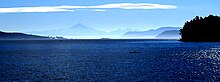
The Canadian Rockies, Coast Mountains and Inside Passage provide some of British Columbia's renowned and spectacular scenery.
In the southwestern corner of B.C., the Lower Fraser Valley forms a flat, fertile triangle of intensively used land.
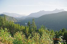
The range is covered in dense temperate rainforest on its western exposures, the range rises to heavily glaciated peaks, including the largest temperate-latitude icefields in the world, and then tapers to the dry Interior Plateau on its eastern flanks, or to the subarctic boreal forest of the Skeena Mountains and Stikine Plateau.
Source Statistics Canada Although little-known to the general public, British Columbia is home to a huge area of volcanoes and volcanic activity in the Pacific Ring of Fire.
[6] Numerous shield volcanoes developed during the Tertiary period in north-central British Columbia and some were active intermittently to recent times.
Mount Edziza is a stratovolcano consisting of a basal shield of basaltic flows surmounted by a central vent and flanked by numerous satellite cones, ash beds and blocky lavas.
It is the northern extension of the Cascade Volcanic Arc in the United States and contains the most explosive young volcanoes in Canada.
It produced an ash column at least 20 km high into the stratosphere and dammed the Lillooet River with breccia.
It formed as a result of faulting, cracking, rifting and the interaction between the Pacific and the North American plates.
The Chilcotin Group in southern British Columbia is thought to have formed as a result of back-arc extension behind the Cascadia subduction zone.
The Wells Gray-Clearwater volcanic field in southeastern British Columbia consists of numerous small, basaltic volcanoes and extensive lava flows.
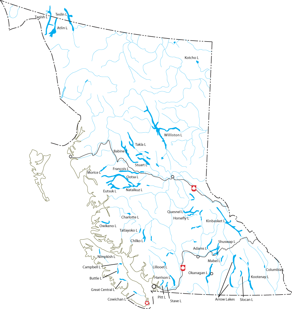
The Fraser River forms an important transportation corridor when it drains much of central and southern British Columbia flowing to the Pacific Ocean.
Hucuktlis Lake on Vancouver Island receives an average of 6,903 mm (271.8 in) of rain annually, and some parts of the area are even classified as warm-summer Mediterranean, some of the northernmost occurrences in the world.
[8] Due to the blocking presence of successive mountain ranges, the climate of some of the interior valleys of the province is semi-arid with certain locations receiving less than 300 mm (12 in) in annual precipitation.
During El Niño events, the jet stream is much farther south across North America, making the province's winters milder and drier than normal.
Regional averages range from 26 °C (79 °F) in higher elevations up to 32 °C (90 °F) in Osoyoos, which has the hottest daytime high temperature in Canada.
In spite of the arid climate, temperature inversions are often created in winter which reduces sunshine to just 1700 to 2000 hours a year, exceptionally little for the dryness.
This region, situated further to the east, typically has similar weather to the southwest interior, although with cooler and wetter conditions due to orographic lift and higher elevation.
The North Coast is one of the cloudiest places in Canada, with Stewart, British Columbia having only 985 hours of sun a year.
Environment Canada subdivides British Columbia into a system of ecozones, each containing smaller ecoregions.
In an ecoregion system advanced by the World Wildlife Fund, British Columbia's ecosystems are divided on five different levels, each classifying the area on a progressively more detailed basis.
Founded as several colonies as part of the British Empire, the political geography is complicated by the fact that during colonization no treaties or conquests of First Nations (the indigenous people) occurred outside of a few small areas of the province.
Other important subdivisions are Ministry of Environment regions (which controls water rights and management, environmental oversight, pesticide and herbicide permits, the British Columbia Conservation Officer Service and Fish and Wildlife Branch; the provincial parks are managed by a sub-department of the Ministry of Environment, BC Parks), health regions (which administer health funding, hospitals and ambulance services), school districts (whose taxation authority is distinct from that of regional districts and organized by tax assessment areas), and mining districts (whose authority under the Mines Act supersedes nearly all other jurisdictions).
The provincial judicial system also subdivides the province into counties, though this is mostly only procedural and does not impact directly on daily life.
All such regions and underlying title and survey descriptions are organized by land districts, which are the cadastral survey system underlying all legal descriptions in the province and date from the original Lands Act in the days of the Colony of British Columbia and Colony of Vancouver Island.
In order to fund community-wide services, such as a sewer system, urban areas incorporate to form municipalities.
The Stikine Region has a permanent population of only 1,352 people, most of them aboriginal, and covers an area of 135,391 square kilometers with no municipalities within its borders.
Each one of these ridings elects one candidate to become its Member of the Legislative Assembly (MLA) in a first past the post race contained within the electoral district.
Patterns of voting established by the right-wing predecessors of the BC Liberal Party, the BC Social Credit Party and the wartime Liberal-Conservative Coalition dominated provincial politics for much of the latter part of the twentieth century and enjoyed power bases on Vancouver's West Side, Victoria's richer suburbs, on the south bank of the Fraser Valley and in the Okanagan and the province's Central Interior and Northeast.
The province of British Columbia currently has 42 electoral districts represented in the House of Commons of Canada.


