Geoid
Generally the geoidal height rises where the Earth's material is locally more dense and exerts greater gravitational force than the surrounding areas.
Being an equigeopotential means the geoid corresponds to the free surface of water at rest (if only the Earth's gravity and rotational acceleration were at work); this is also a sufficient condition for a ball to remain at rest instead of rolling over the geoid.
Earth's gravity acceleration (the vertical derivative of geopotential) is thus non-uniform over the geoid.
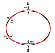
Although the "ground" of the Earth has excursions on the order of +8,800 m (Mount Everest) and −11,000 m (Marianas Trench), the geoid's deviation from an ellipsoid ranges from +85 m (Iceland) to −106 m (southern India), less than 200 m total.
[4] If the ocean were of constant density and undisturbed by tides, currents or weather, its surface would resemble the geoid.
The permanent deviation between the geoid and mean sea level is called ocean surface topography.
Geodesists are able to derive the heights of continental points above the geoid by spirit leveling.
Generally the geoid rises where the Earth's material is locally more dense, exerts greater gravitational force, and pulls more water from the surrounding area.
(An analogous relationship exists between normal heights and the quasigeoid, which disregards local density variations.)
In practice, many handheld GPS receivers interpolate N in a pre-computed geoid map (a lookup table).
That is because GPS satellites, orbiting about the center of gravity of the Earth, can measure heights only relative to a geocentric reference ellipsoid.
When height is not zero on a ship, the discrepancy is due to other factors such as ocean tides, atmospheric pressure (meteorological effects), local sea surface topography, and measurement uncertainties.
In such combination solutions, the low-resolution part of the geoid solution is provided by the satellite data, while a 'tuned' version of the above Stokes equation is used to calculate the high-resolution part, from terrestrial gravimetric data from a neighbourhood of the evaluation point only.
[10][11][12][13] Geoid undulations display uncertainties which can be estimated by using several methods, e.g., least-squares collocation (LSC), fuzzy logic, artificial neural networks, radial basis functions (RBF), and geostatistical techniques.
Geostatistical approach has been defined as the most-improved technique in prediction of geoid undulation.
[14] Variations in the height of the geoidal surface are related to anomalous density distributions within the Earth.
[15] The surface of the geoid is higher than the reference ellipsoid wherever there is a positive gravity anomaly or negative disturbing potential (mass excess) and lower than the reference ellipsoid wherever there is a negative gravity anomaly or positive disturbing potential (mass deficit).
[16] This relationship can be understood by recalling that gravity potential is defined so that it has negative values and is inversely proportional to distance from the body.
As a consequence, the geoid's defining equipotential surface will be found displaced away from the mass excess.
The presence of a localized inclusion in the background medium will rotate the gravity acceleration vectors slightly towards or away from a denser or lighter body, respectively, causing a bump or dimple in the equipotential surface.
[17] The largest absolute deviation can be found in the Indian Ocean Geoid Low, 106 meters below the average sea level.
[19] Recent satellite missions, such as the Gravity Field and Steady-State Ocean Circulation Explorer (GOCE) and GRACE, have enabled the study of time-variable geoid signals.
The first products based on GOCE satellite data became available online in June 2010, through the European Space Agency.
[20][21] ESA launched the satellite in March 2009 on a mission to map Earth's gravity with unprecedented accuracy and spatial resolution.
On 31 March 2011, a new geoid model was unveiled at the Fourth International GOCE User Workshop hosted at the Technical University of Munich, Germany.
[22] Studies using the time-variable geoid computed from GRACE data have provided information on global hydrologic cycles,[23] mass balances of ice sheets,[24] and postglacial rebound.
[25] From postglacial rebound measurements, time-variable GRACE data can be used to deduce the viscosity of Earth's mantle.
The current best such set of spherical harmonic coefficients is EGM2020 (Earth Gravitational Model 2020), determined in an international collaborative project led by the National Imagery and Mapping Agency (now the National Geospatial-Intelligence Agency, or NGA).
For many applications, the complete series is unnecessarily complex and is truncated after a few (perhaps several dozen) terms.
[29] EGM2020 is the international follow-up that was originally scheduled for 2020 (still unreleased in 2024), containing the same number of harmonics generated with better data.


- Ocean
- Ellipsoid
- Local plumb line
- Continent
- Geoid