Hurricane Hanna (2008)
Hurricane Hanna was a moderately powerful but deadly tropical cyclone that caused extensive damage across the Western Atlantic, mostly in the Turks and Caicos Islands and the East Coast of the United States.
Initially, the storm struggled to intensify due to moderate wind shear as it moved westwards towards the Bahamas.
By August 31, Hanna had drifted southwards and began intensifying while over the Bahamas; it attained its peak intensity as a Category 1 hurricane while over the Turks and Caicos Islands.
Due to the outflow of the nearby Hurricane Gustav, Hanna weakened back into a tropical storm the next day as it began to drift northwestwards towards the Southeastern United States.
[1] At the time, the low-level center of circulation was partially exposed on the western edge of the mass of convection, indicating westerly wind shear.
[2] Tracking westward primarily under the steering current of a large ridge to the north, the convective pattern began to redevelop late on August 28.
Since forecast, models predicted the storm would weaken and move southwestward due to outflow associated with nearby Hurricane Gustav.
At the same time, the low-level center once again became separated from the convection, which was primarily confined to a cyclonic banding feature in the eastern half of the circulation.
Due to the influence of Hurricane Gustav's large circulation, Hanna suddenly took a sharp southerly turn and slowed down to drift while located to the north of the Turks and Caicos Islands.
[10] The National Hurricane Center and various governments issued multiple tropical cyclone warnings and watches due to the threat of Hanna.
In southeastern Bahamas and the Turks and Caicos Islands, a tropical storm watch was posted at 15:00 UTC on August 30.
[12] Along the northern coast of Haiti, a tropical storm warning was issued from Môle-Saint-Nicolas to the border with Dominican Republic at 15:00 UTC on September 2.
Simultaneously, another tropical storm warning was issued along the north coast of Dominican Republic from Puerto Plata westward to Bahia de Manzanillo.
[1] At 09:00 UTC on September 4, a tropical storm watch was issued from the mouth of the Altamaha River in Georgia to Edisto Beach, South Carolina.
[1] On September 5 at 09:00 UTC, the tropical storm warning in effect from the mouth of the Altamaha River to the Currituck Beach Light was extended northward to Chincoteague, Virginia and included a portion of Chesapeake Bay.
[1] The tropical storm watch from the North Carolina–Virginia state line to Great Egg Harbor was northward extended to Sandy Hook, New Jersey, while the portion south of Chincoteague was discontinued at 0:900 UTC on September 5.
[13] In Florida, Governor Charlie Crist declared a state of emergency as Hanna initially appeared to be a threat.
Governor Crist declined to attend the Republican National Convention in Saint Paul, Minnesota and remarked that, "We've got a lot coming at us, and I think it's important to be here ...
[15] On September 5, rural water associations in the Carolinas and neighboring states prepared staff and equipment to respond to emergencies.
Nearby at Shea Stadium, the baseball game between the New York Mets and Philadelphia Phillies was cancelled in advance of the storm, rescheduled as a day-night doubleheader on September 7.
[22] Power companies on Long Island were preparing for a minimal hurricane and the first real test of New York's readiness for a strong storm impacting the region.
[1] Along the coast of the Southeastern United States, three people drowned offshore Florida due to rip currents.
[28] Widespread rain and strong winds were reported in the Bahamas and Turks and Caicos Islands as a result of Hanna.
Many roads were inundated and suffered damage, including to a recently completed causeway linking North and Middle Caicos Islands.
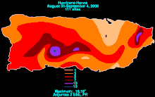
[1] Haiti, already rain-saturated by Fay and Gustav, was hit hard by flooding and mudslides from several days of heavy rainfall, particularly in the city of Gonaïves which also suffered catastrophic damage in 2004 from Hurricane Jeanne.
[35] Over a week after Hanna brushed the Dominican Republic, the body of a fisherman who drowned in the storm was found in the Atlantic just off the northern coast.
A 14-year-old boy drowned at John U. Lloyd Beach State Park near Hollywood, Florida, as a result of the rip currents brought up by the distant Hanna.

Tropical storm (39–73 mph, 63–118 km/h)
Category 1 (74–95 mph, 119–153 km/h)
Category 2 (96–110 mph, 154–177 km/h)
Category 3 (111–129 mph, 178–208 km/h)
Category 4 (130–156 mph, 209–251 km/h)
Category 5 (≥157 mph, ≥252 km/h)
Unknown