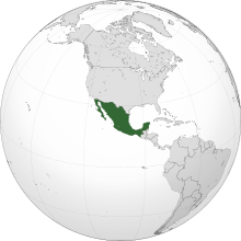
List of conflicts in Mexico

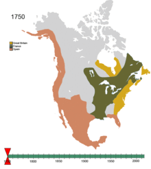
This is a list of conflicts in Mexico arranged chronologically starting from the Pre-Columbian era (Lithic, Archaic, Formative, Classic, and Post-Classic periods/stages of North America; c. 18000 BCE – c. 1521 CE) up to the colonial and postcolonial periods (c. 1521 CE – Present[update]).

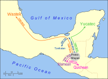
This list includes any raid, strike, skirmish, siege, sacking, and/or battle (land, naval, and air) that occurred on the territories of what may today be referred to as Mexico (Mesoamerica, Aridoamerica, and Oasisamerica); however, in which the conflict itself may have only been part of an operation of a campaign in a theater of a greater war (e.g. any and/or all border, undeclared, colonial, proxy, liberation, global, Indian wars, etc.).

There may also be periods of violent, civil unrest listed; such as, shootouts, spree killings, massacres, terrorist attacks, coups, assassinations, regicides, riots, rebellions, revolutions, and civil wars (as well as wars of succession and/or independence).

The list might also contain episodes of human sacrifice, mass suicide, and ethnic cleansing/genocide.

An orthographic projection map detailing the present-day location and territorial extent of Mexico in North America .
A map detailing the pre-Columbian distribution of the language families of indigenous North American peoples (including those of Northern Mexico ).
A map detailing the approximated migration routes and dates for various Mayan language families. The region labeled under Proto-Mayan is now occupied by speakers of the branch of Qʼanjobalan languages (light blue in other figures).
A map detailing the location and extent of Mayan-speaking populations .
A map detailing the general area of the Mayan civilization and its city-states in the greater Mesoamericanregion . The settlements of Calakmul (in Mexico) and Tikal (in Guatemala ) both developed near the center of this civilization.
A map detailing the Valley of Mexico basin ( c. 1519 CE).
A map detailing the location and territorial extent of the Tarascan empire (in green).
A map detailing the territorial extent of the Tepanec empire with their capital ( Azcapotzalco ) near the center:
c. 1222 – c. 1283 CE
c. 1283 – c. 1414 CE
c. 1414 – c. 1431 CE
A map showing the expansion of the Aztec Empire , showing the areas conquered by the Aztec rulers.
A map showing the maximal, territorial extent of the Aztec Empire (according to María del Carmen Solanes Carraro and Enrique Vela Ramírez).
A map depicting Cortés' invasion route from the Gulf Coast of Mexico to the Aztec capital ( Tenochtitlan ).
A map detailing the early entry routes of conquistadores such as Pedro de Alvarado and Luis Marín into Chiapas ( c. 1523 – c. 1525 ). Highland regions are shaded.
A map detailing the territorial extent of the realms of the king of Spain by the name of Philip the Prudent ( r. 1556–1598, 1580–1598 ) as appointed to and administered by:
A map detailing the maximum territorial extent of the Spanish empire ( c. 1714 – c. 1800 ).
An animated map detailing the territorial evolution of non-native North American nation-states ( c. 1750 – c. 2008 ).
Government under traditional Spanish law
Loyal to Supreme Central Junta or Cortes
American junta or insurrection movement
Independent state declared or established
Height of French control of the Peninsula
A map detailing towns along the route of the campaign of Miguel Hidalgo y Costilla during the Mexican War of Independence.
A map detailing the campaigns of José María Morelos during the Mexican War of Independence.
A map detailing the territories of Northern America declared to belong to the First Mexican Empire ( c. 1821 ). Northern border from the later Adams–Onís Treaty .
A map detailing the territorial organization of the Provisional Government of Mexico (1823).
An animated map detailing the territorial evolution of Mexico from 1824–1974.
A map displaying the routes of Comanche raiders starting from Comancheria (near or all around Big Spring, Texas ) and reaching as far south as Querétaro (1,400 kilometres away).
A map detailing the Centralist Republic of Mexico with the separatist movements generated by its dissolution.
Independent territories
Territories claimed by the Republic of Texas
Territories claimed by the Republic of the Rio Grande
Rebellions
An overview map of the Mexican–American War including engagements of the Pacific Coast campaign.
A map of Mexico showing the location of the Crabb massacre.
A map showing the location of the Crawford affair (in 1886) during the Geronimo campaign.
A map of Sonora showing the location of the Battle of Mazocoba near Guaymas on (in 1900) between the Mexican Army and Yaqui .
A map detailing principal battles during the fight to oust Porfirio Díaz (1910–1911). Most action was in the northern border area, with the Battle of Ciudad Juárez being a decisive blow, but the struggle in Morelos by the Zapatistas was also extremely important, since the state was just south of the Mexican capital.
A map detailing the various battles between the Villistas and United States Armed Forces (1915–1920).
A map detailing the Mexico–United States border . The border spans four U.S. states , six Mexican states , and has over twenty commercial crossings.
A map of Mexico showing conflict zones of the Cristero War and regions in which outbreaks occurred
Large-scale outbreaks
Moderate outbreaks
Sporadic outbreaks
A photograph of a P-51 Mustang from the Guatemalan Air Force firing warning shots at a Mexican fishing vessel crossing the nautical border into Guatemala in 1958.