Microwave radiometer
They are usually equipped with multiple receiving channels to derive the characteristic emission spectrum of planetary atmospheres, surfaces or extraterrestrial objects.
This means components like dry gases, water vapor, or hydrometeors interact with microwave radiation but overall even the cloudy atmosphere is not completely opaque in this frequency range.
They allow the derivation of important meteorological quantities such as vertical temperature and humidity profiles, columnar water vapor quantity, and columnar liquid water path with a high temporal resolution on the order of minutes to seconds under nearly all weather conditions.
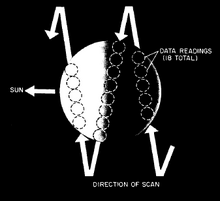
In 1962 the Mariner-2 mission was launched by NASA in to investigate the surface of Venus including a radiometer for water vapor and temperature observations.
The launch of the Scanning Multichannel Microwave Radiometer in 1978 became an important milestone in the history of radiometry.
Ground-based radiometers for the determination of temperature profiles were first explored in the 1960s and have since improved in terms of reduced noise and the ability to run unattended 24/7 within worldwide observational networks.
Solids, liquids (e.g. the Earth's surface, ocean, sea ice, snow, vegetation) but also gases emit and absorb microwave radiation.
They provide specific absorption features shown at a figure on the right which allow to derive information about their abundance and vertical structure.
Besides the distinct absorption features of molecular transition lines, there are also non-resonant contributions by hydrometeors (liquid drops and frozen particles).
These scattering effects can be used to distinguish between rain and cloud water content exploiting polarized measurements[10] but also to constrain the columnar amount of snow and ice particles from space[11] and from the ground.
Increasingly low noise amplifiers are becoming available at higher frequencies, i.e. up to 100 GHz, making heterodyne techniques obsolete.
Usually ground-based radiometers are also equipped with environmental sensors (rain, temperature, humidity) and GPS receivers (time and location reference).
As a cold target one can use either a liquid nitrogen cooled blackbody (77 K) or a zenith clear sky TB that was obtained indirectly from radiative transfer theory.
Signals at the center of the absorption complex are dominated by the atmosphere closest to the radiometer (when ground-based).
Microwave instruments are flown on several polar orbiting satellites for Earth observation and operational meteorology as well as part of extraterrestrial missions.
MWRnet aims to facilitate the exchange of information in the MWR user community fostering the participation to coordinated international projects.
In the long run, MWRnet’s mission aims at setting up operational software, quality control procedures, data formats, etc.