Oklahoma panhandle
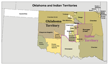
The area became part of New Spain with the Adams–Onís Treaty of 1819, which set the western boundary of the Louisiana Purchase at the 100th meridian.
Black Mesa, the highest point in Oklahoma at 4,973 feet (1,516 m), is located in Cimarron County.
The panhandle occupies nearly all of the true High Plains within Oklahoma, being the only part of the state lying west of the 100th meridian, which generally marks the westernmost extent of moist air from the Gulf of Mexico.
[4] Shortly before the arrival of European explorers,[5] the panhandle was home to Southern Plains villagers.
From 1200 to 1500, the semi-sedentary panhandle culture peoples, including the Antelope Creek phase,[6] lived in the region in large, stone-slab and plaster houses in villages or individual homesteads.
[6] The arrival of horses from Spain in the 16th century allowed American Indian tribes to increase their hunting ranges.
The Adams–Onís Treaty of 1819 between Spain and the United States set the western boundary of this portion of the Louisiana Purchase at the 100th meridian.
The cutoff passed several miles north of what are now Boise City, Oklahoma, and Clayton, New Mexico, before continuing toward Santa Fe.
Under the Compromise of 1850, Texas surrendered its lands north of 36°30', rather than have a portion of the state as "free" territory.
Gradually they organized themselves into ranches and established their own rules for arranging their land and adjudicating their disputes.
[11] In 1886, Interior Secretary L. Q. C. Lamar declared the area to be public domain and subject to "squatter's rights".
They surveyed their own land and by September 1886 had organized a self-governing and self-policing jurisdiction, which they named the Cimarron Territory.
Senator Daniel W. Voorhees of Indiana introduced a bill in Congress to attach the so-called territory to Kansas.
[11] The organization of Cimarron Territory began soon after Secretary Lamar declared the area open to settlement by squatters.
Capital and new settlers came into the area, and the first railroad, the Rock Island, built a line through the county from Liberal, Kansas, to Dalhart, Texas.
The dust storms were largely a result of poor farming techniques and the plowing up of the native grasses that had held the fine soil in place.
Despite government efforts to implement conservation measures and change the basic farming methods of the region, the Dust Bowl persisted for nearly a decade.
[citation needed] The social impact of the dust bowl and the resulting emigration of tenant farmers from Oklahoma is the setting for the 1939 novel The Grapes of Wrath by Nobel Prize-winning author John Steinbeck.
[citation needed] As of the 2010 census, there were a total of 28,751 people, 10,451 households, and 7,466 families in the three counties that comprise the Oklahoma panhandle.
County seat† The panhandle is rather thinly populated (when compared to the rest of Oklahoma) making the labor force in this region very small.
The region's higher educational needs are served by Oklahoma Panhandle State University in Goodwell, 10 miles southwest of Guymon.