Northumberland County, Pennsylvania
Among its notable residents are Thomas L. Hamer, a Democratic member of Congress in the 1830s, and Joseph Priestley, the Enlightenment chemist and theologian, who left England in 1796 due to religious and political persecution and settled on the Susquehanna River.
His former house, originally purchased by chemists from Pennsylvania State University after a colloquium that founded the American Chemical Society,[4] is a historical museum.
By 1813 the area once comprising the sprawling county of Northumberland had been divided over time and allotted to other counties such that lands once occupied by Old Northumberland at its greatest extent are now found in Centre, Columbia, Luzerne, Lycoming, Mifflin, Union, Clearfield, Clinton, Montour, Bradford, Lackawanna, Susquehanna, Wyoming, Tioga, Potter, McKean, Warren, Venango, Snyder, and Schuylkill Counties.
The United States Office of Management and Budget[16] has designated Northumberland County as the Sunbury, PA Micropolitan Statistical Area (μSA).
[19] While county-level politics tend to be competitive, Northumberland is a Republican county in most statewide elections.
The only Democratic statewide candidate to carry the county in 2008 was incumbent Auditor General Jack Wagner.
Northumberland County Career Technology Center located in Coal Township Central Susquehanna Intermediate Unit 16 – The primary service area consists of: Columbia, Montour, Northumberland, Snyder and Union counties in central Pennsylvania.
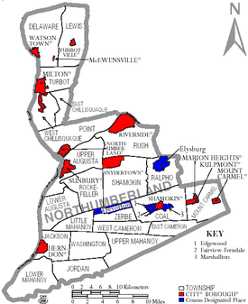
Under Pennsylvania law, there are four types of incorporated municipalities: cities, boroughs, townships, and, in one case, a town.
The following cities, boroughs, and townships are located in Northumberland County: Census-designated places are geographical areas designated by the U.S. Census Bureau for the purposes of compiling demographic data.