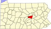
Snyder County, Pennsylvania
Snyder County is one of the 423 counties served by the Appalachian Regional Commission,[5] and it is identified as part of the "Midlands" by Colin Woodard in his book American Nations: A History of the Eleven Rival Regional Cultures of North America.
[6] With over 400 active farms in the county, agriculture plays an important role in the economy and environment.
Snyder has a humid continental climate, which is hot-summer (Dfa) except in higher elevations, where it is warm-summer (Dfb).
The United States Office of Management and Budget[18] has designated Snyder County as the Selinsgrove, PA Micropolitan Statistical Area (μSA).
[22] The last Republican presidential candidate to lose Snyder County was incumbent president William Howard Taft when he split the Republican vote with challenger and former president Theodore Roosevelt, who took the county for the insurgent Progressive Party.
[23] In fact, no Democratic presidential candidate has been able to claim the county since Pennsylvania native James Buchanan won the presidency in 1856.
The county is located in Pennsylvania's 12th congressional district, which has a Cook Partisan Voting Index of R+17 and is represented by Republican Fred Keller.
As part of Pennsylvania Senate, District 27 it is represented by Republican John Gordner.
Three 138 kilovolt lines stem from this 500 kilovolt line at the Sunbury Generation coal-fired power plant in Shamokin Dam, which is capable of producing roughly 400 megawatts of electrical power.
High-speed Internet access is principally provided by Verizon, EvenLink, and Service Electric Cablevision.
Manufacturing since the year 2001 was faced with the largest loss in employment in Snyder County.
As reported by the National Center for Educational Statistics[28] Snyder County has two main arteries.
Routes 11/15 travel through the county on the east end generally following the path of the Susquehanna River.
U.S. Route 522 begins in Selinsgrove and travels west through Kreamer, Middleburg and on to Lewistown.
Under Pennsylvania law, there are four types of incorporated municipalities: cities, boroughs, townships, and, in at most two cases, towns.
The following boroughs and townships are located in Snyder County: Census-designated places are geographical areas designated by the U.S. Census Bureau for the purposes of compiling demographic data.
[19] † county seat Snyder County is well known for its unmistakable Pennsylvania German language and culture, agricultural heritage, as well as its fraktur, Kentucky rifles, wood products industries, Middleswarth chip factory, and the annual fairs, festivals, and auctions that keep the local heritage alive.
Some of the more famous historical structures of the county are the Governor Snyder Mansion, Pomfret's Castle, Schoch Block House, ruins of the Pennsylvania Canal, and its covered bridges.