Tropical Storm Agatha
The first named storm of the 2010 Pacific hurricane season, Agatha originated from the Intertropical Convergence Zone, a region of thunderstorms across the tropics.
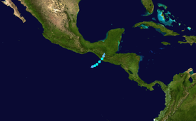
Tropical Storm Agatha originated from an area of convection, or thunderstorms, that developed on May 24, off the west coast of Costa Rica.
[7] The next day, it briefly became disorganized,[8] as its circulation was broad and elongated; however, the disturbance was in a very moist environment, and multiple low level centers gradually organized into one.
Around this time, it was noted that there was a 40% chance of the system undergoing rapid intensification within the following 24 hours as the only limiting factor was its proximity to land.
[13] However, the storm failed to intensify much, peaking in intensity with winds of 45 mph (75 km/h) and a barometric pressure of 1001 mbar (hPa; 29.56 inHg).
[1] After landfall, Agatha continued to cause floods and landslides, however it did not bring a lot of tropical storm force winds on shore.
[14] The system weakened quickly after coming on shore, dropping its winds to 25 mph (20 knots, 40 km/h) and its pressure to 1007 mbar (hPa; 29.74 inHg) before dissipating.
On June 1, the National Hurricane Center stated that the remnants of Tropical Storm Agatha had only a low chance of regeneration in the western Caribbean Sea.
Due to the system's proximity to land, tropical storm force winds were expected to reach the coast by the evening hours, making outdoor preparations difficult.
This rain was expected to produce large-scale, life-threatening flash flooding and landslides across Guatemala, El Salvador and southeastern Mexico.
[21] In response to the approaching storm, a yellow alert was declared for all of El Salvador and it was estimated that roughly 89% of the country was at risk from flooding.
Roughly 52,000 police, emergency rescue personnel and soldiers were placed on standby by the Dirección General de Protección Civil.
[22] Prior to becoming a tropical depression, the system produced torrential rainfall in Nicaragua, resulting in the death of one person after she was swept away by a swollen river.
[24] Two days before landfall, on May 27 the Pacaya volcano, roughly 25 mi (40 km) south of Guatemala City, erupted, killing one person and forcing over 2,000 people to evacuate, and causing the temporary closing of the main international airport.
[52] After moving inland over Guatemala and Mexico, torrential rains from the remnants of Agatha triggered flash flooding and landslides in parts of Honduras.
[37] According to the Office for the Coordination of Humanitarian Affairs, a total of 12 people were killed by Agatha throughout El Salvador and roughly 120,000 individuals were affected across 116 municipalities.
Unlike Guatemala which suffered extreme damage in its educational sector, most schools in El Salvador were functional after the storm's passage.
[64] By June 1, the Government of Guatemala sent an appeal to the United Nations for roughly $100 million in international assistance to deal with damage wrought by Agatha.
[65] On June 14, President Colom stated that it would take at least five years to recover from Tropical Storm Agatha due to the widespread nature of the catastrophe.
[65] As Agatha dissipated over Guatemala, the Government of Mexico expressed their sincere condolences to the two countries and offered to provide the necessary support for them to recover.
[71] The Government of France also passed on their condolences to the countries suffering from the disaster and pledged to send emergency humanitarian aid to the region.
[63] The United States provided immediate funds of GTQ 900,000 (US$112,000); USAID also planned to deploy relief teams with food and emergency supplies to bring to those affected by the storm.
[76] Extensive losses of the country's food supply left tens of thousands of residents without sustenance, leading to fears of widespread hunger in the nation.
In attempts to lessen the severity of the hunger outbreak, the WFP set up over 200 shelters across the country and was estimated to be serving 50,000 people a day by June 9.
Tropical storm (39–73 mph, 63–118 km/h)
Category 1 (74–95 mph, 119–153 km/h)
Category 2 (96–110 mph, 154–177 km/h)
Category 3 (111–129 mph, 178–208 km/h)
Category 4 (130–156 mph, 209–251 km/h)
Category 5 (≥157 mph, ≥252 km/h)
Unknown


