Tropical Storm Wukong (2006)
On August 13, both the Japan Meteorological Agency (JMA) and the Joint Typhoon Warning Center (JTWC) classified the depression as a tropical storm.
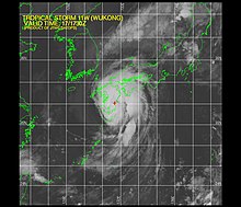
Wukong made landfall at peak intensity late on August 17 near Miyazaki City in southern Kyūshū.
On August 12, the Japan Meteorological Agency (JMA) began monitoring a tropical depression located to the south of Chichi-jima island.
[2] Several hours after entering the Sea of Japan, the JMA downgraded Wukong to a tropical depression.
[1] According to Japanese weather officials, heavy rain, flood, storm and high wave warnings were put into effect for all of Kyūshū and adjacent areas in Honshū.
[5] Wukong produced torrential rains over Japan, peaking at 516 mm (20.3 in) in Hinokage, Miyazaki Prefecture.
[7] As the storm brushed the Korean Peninsula, it produced heavy rains, but caused no known damage.

Tropical storm (39–73 mph, 63–118 km/h)
Category 1 (74–95 mph, 119–153 km/h)
Category 2 (96–110 mph, 154–177 km/h)
Category 3 (111–129 mph, 178–208 km/h)
Category 4 (130–156 mph, 209–251 km/h)
Category 5 (≥157 mph, ≥252 km/h)
Unknown