Voyageurs National Park
The park's name commemorates the voyageurs—French-Canadian fur traders who were the first European settlers to frequently travel through the area.
[3] Notable for its outstanding water resources, the park is popular with canoeists, kayakers, other boaters, and fishermen.
The Kabetogama Peninsula, which lies entirely within the park and makes up most of its land area, is accessible only by boat.
[4] Voyageurs National Park is located on the Canadian Shield, with the rocks averaging between 1 and 3 billion years old.
[5] Formed during the early ages of the earth formation, the rocks of the park were compressed, and folded under tremendous pressure.
Over time, additional layers of sedimentary rocks developed on top, to be stripped away by the continental glaciers of the Wisconsin Glacial epoch and earlier.
[6] Most of the rocks in the park belong to the Archeon Quetico Subprovince, of the Superior Physiographic province, associated with the Kenoran Orogeny.
The northwest corner of the park contains metamorphosed rocks of the Wabigoon subprovince, which form a northeast trending greenstone belt.
[9] The major lakes in the park are home to Walleye, Northern pike, Muskellunge, Smallmouth bass, and Crappie.
Lake Whitefish are also a popular quarry via sport netting in the fall when they move into shallow water to spawn.
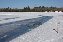
Available activities include lake driving, snowmobiling, cross-country skiing, winter camping, ice fishing and snowshoe hiking.
As it nears Kettle Falls, it turns south up a deep bay and then overland to avoid the soft ice along the narrows.
According to the United States Department of Agriculture, the Plant Hardiness zone at the Ash River Visitor Center (1129 ft / 344 m) is 3a with an average annual extreme minimum temperature of -36.3 °F (-37.9 °C).
[18] This national park is home to timber wolves,[19] black bear, moose, an abundance of white-tailed deer, and smaller mammals such as fox, beaver, river otter, muskrat, snowshoe hare, and weasel which may be seen crossing frozen lake surfaces during the winter.
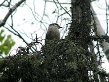
[20] Bald eagle, loon, double-crested cormorant, owl, and warblers are common birds found.
It wasn't until nearly eighty years later that federal legislation authorizing the creation of the park was signed into law by President Richard Nixon on January 8, 1971.
As competition in the east depleted the beaver, the voyageurs expanded their range into the northwest territories of North America.
Here along the modern border of the United States and Canada, the Cree, Monsoni, and Assiniboine tribes were first Native American contacts.
[23] Logging came to the northwoods as the stands of white pine in Michigan, Wisconsin and central Minnesota were harvested.
The Virginia and Rainy Lake Lumber Company harvested trees to the east in Saint Louis County.
[24] In the summer of 1893 George Davis, funded by Charles Moore, discovered gold on Rainy Lake.
With confirmation of the discovery, Charles Moore hired Jeff Hildreth, a miner from the Black Hills to obtain title to the island.
Twenty properties, containing over 50 structures, will be retained and managed by the National Park Service because of their historic significance.
Kettle Falls can only be reached by boat in the summer months and is one of the few places in the lower forty-eight states where one looks south into Canada.
[29] Surveyor's IslandSurveyor's Island is on the east end of Rainy Lake marking the entry to the American Channel to Kettle Falls.
Rainy Lake City is the northwestern point of the Kabetogama Peninsula facing Little American Island and the mainland.
[29] Hacksaw Pass Here, visitors may visit several wetlands, the Gold Portage, Woodenfrog family residence and other sites related to Ojibwe history.
[29] The bay is located on the southern shore of Namakan Lake, east of Ash River and the visitor center.
The company chose not to cut the red pine on the site and many of the trees have reached a large, mature state.
The estate was visible from the lake just north of Harrison Narrows;[29] however, the lodge collapsed in 2014 due to a combination of structural weakness, incomplete maintenance, and heavy weather.