Water on Mars
[1] What was thought to be low-volume liquid brines in shallow Martian soil, also called recurrent slope lineae,[2][3] may be grains of flowing sand and dust slipping downhill to make dark streaks.
[10][11] Some liquid water may occur transiently on the Martian surface today, but limited to traces of dissolved moisture from the atmosphere and thin films, which are challenging environments for known life.
[58] Gullies and slope lineae along cliffs and crater walls suggest that flowing water continues to shape the surface of Mars, although to a far lesser degree than in the ancient past.
[70][71] Understanding the extent and situation of water on Mars is vital to assess the planet's potential for harboring life and for providing usable resources for future human exploration.
"[73][74] In March 2021, researchers reported that a considerable amount of water on ancient Mars has remained but that, for the most part, has likely been sequestered into the rocks and crust of the planet over the years.
[75][76][77][78] In August 2024, further analysis of data from NASA's InSight Mars Lander enabled researchers to discover a reservoir of liquid water at depths of 10–20 kilometres (6.2–12.4 mi) under the Martian crust.
[81] The person most responsible for popularizing this view of Mars was Percival Lowell (1855–1916), who imagined a race of Martians constructing a network of canals to bring water from the poles to the inhabitants at the equator.
The majority view of the scientific establishment at the time is probably best summarized by English astronomer Edward Walter Maunder (1851–1928) who compared the climate of Mars to conditions atop a twenty-thousand-foot (6,100 m) peak on an arctic island[82] where only lichen might be expected to survive.
A fraction of this water is retained on modern Mars as both ice and locked into the structure of abundant water-rich materials, including clay minerals (phyllosilicates) and sulfates.
[94][95] Studies of hydrogen isotopic ratios indicate that asteroids and comets from beyond 2.5 astronomical units (AU) provide the source of Mars' water,[96] that currently totals 6% to 27% of the Earth's present ocean.
[100] For example, mineralogical models of the rock outcroppings examined by instruments on the Opportunity rover at Meridiani Planum suggest that the sulfate deposits there could contain up to 22% water by weight.
A recent study has argued that hypothetical serpentinites in the ancient highland crust of Mars could hold as much as a 500 metres (1,600 ft)-thick global equivalent layer (GEL) of water.
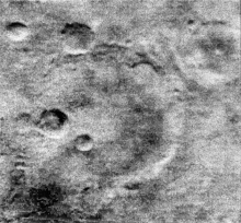
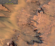
[31] Martian water-worn features can be classified into two distinct classes: 1) dendritic (branched), terrestrial-scale, widely distributed, Noachian-age valley networks and 2) exceptionally large, long, single-thread, isolated, Hesperian-age outflow channels.
Recent work suggests that there may also be a class of currently enigmatic, smaller, younger (Hesperian to Amazonian) channels in the mid-latitudes, perhaps associated with the occasional local melting of ice deposits.
Two major putative shorelines have been suggested: a higher one, dating to a time period of approximately 3.8 billion years ago and concurrent with the formation of the valley networks in the Highlands, and a lower one, perhaps correlated with the younger outflow channels.
[210] They conclude that liquid water on today's Mars may be limited to traces of dissolved moisture from the atmosphere and thin films, which are challenging environments for life as it is currently known.
[144] The current atmospheric reservoir of water is important as a conduit allowing gradual migration of ice from one part of the surface to another on both seasonal and longer timescales, but it is insignificant in volume, with a WEG of no more than 10 micrometres (0.00039 in).
[262] Evidence from Mars Odyssey's gamma ray spectrometer and direct measurements with the Phoenix lander have corroborated that many of these features are intimately associated with the presence of ground ice.
[144] A cover of debris is required both to explain the dull surfaces seen in the images that do not reflect like ice, and also to allow the patches to exist for an extended period of time without subliming away completely.
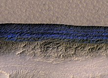
[284][285] Recent evidence has led many planetary scientists to conclude that water ice still exists as glaciers across much of the Martian mid- and high latitudes, protected from sublimation by thin coverings of insulating rock and/or dust.
An additional complication is that the ~25% lower brightness of the young Sun would have required an ancient atmosphere with a significant greenhouse effect to raise surface temperatures to sustain liquid water.
[304] During the middle to late Noachean era, Mars underwent potential formation of a secondary atmosphere by outgassing dominated by the Tharsis volcanoes, including significant quantities of H2O, CO2, and SO2.
[312][313] Mars has experienced about 40 large scale changes in the amount and distribution of ice on its surface over the past five million years,[314][288] with the most recent happening about 2.1 to 0.4 Myr ago, during the Late Amazonian glaciation at the dichotomy boundary.
[271][272][321][322] This ice-rich mantle, that can be 100 meters thick at mid-latitudes,[323] smoothes the land at lower latitudes, but in places it displays a bumpy texture or patterns that give away the presence of former water ice underneath.
[325] Habitable environments need not be inhabited, and for purposes of planetary protection, scientists are trying to identify potential habitats where stowaway bacteria from Earth on spacecraft could contaminate Mars.
[355] Stable liquid water cannot exist on the surface of Mars with its present low atmospheric pressure and temperature (it would boil), except at the lowest elevations for short periods.
[389] The work was corroborated by a separate study that used recorded gravity data to estimate the density of the Planum Boreum, indicating that on average, it contained up to 55% by volume of water ice.
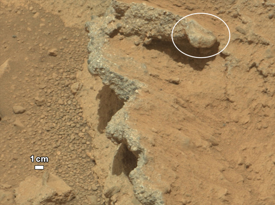
[395] On September 26, 2013, NASA scientists reported the Mars Curiosity rover detected abundant chemically-bound water (1.5 to 3 weight percent) in soil samples at the Rocknest region of Aeolis Palus in Gale Crater.
[406][407][408] On April 13, 2015, Nature published an analysis of humidity and ground temperature data collected by Curiosity, showing evidence that films of liquid brine water form in the upper 5 cm of Mars's subsurface at night.
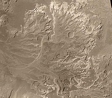
[2][409] On October 8, 2015, NASA confirmed that lakes and streams existed in Gale crater 3.3 – 3.8 billion years ago delivering sediments to build up the lower layers of Mount Sharp.


