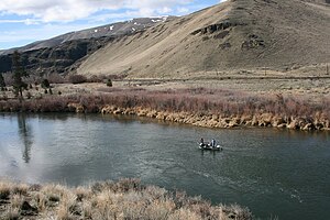
Umtanum Ridge Water Gap
These anticlines are part of the Yakima Fold Belt near the western edge of the Columbia River Plateau.
The great basalt flows of the Columbia Basin and of the Ellensburg Formation, in some places over 5000 meters (17,000 feet) thick, have been folded into ridges (anticlines) and valleys (synclines) running roughly east–west as a result of north–south compression.
This unusual juxtaposition (rivers cutting through ridges rather than flowing through apparently more favorable routes) is an example of geologic precedence.
The ancient Yakima River is believed to have been there, flowing southward above the relatively flat basalt layers.
The river continued to follow its historic course, cutting downward through the basalt to maintain a relative level.