Bennys Run
It then turns north-northeast for a few tenths of a mile before crossing Pennsylvania Route 61 and reaching its confluence with Shamokin Creek.
[1] Bennys Run joins Shamokin Creek 18.20 miles (29.29 km) upstream of its mouth.
[4] However, in 2005 and 2006, the Pennsylvania Department of Environmental Protection received complaints about untreated sewage discharge into the creek.
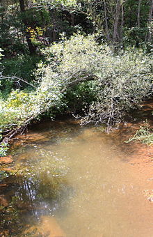
[1] Bennys Run is a small and shallow stream situated in Irish Valley.
[5] Bennys Run was entered into the Geographic Names Information System on August 2, 1979.
[9] A concrete tee beam bridge carrying Pennsylvania Route 61 over Bennys Run was built in 1947.
In 1967, a prestressed box beam or girders bridge was built over the stream 1 mile (1.6 km) west of Weigh Scales in 1967.
This bridge is located 3 miles (4.8 km) west of Weigh Scales and is 26.9 feet (8.2 m) long.